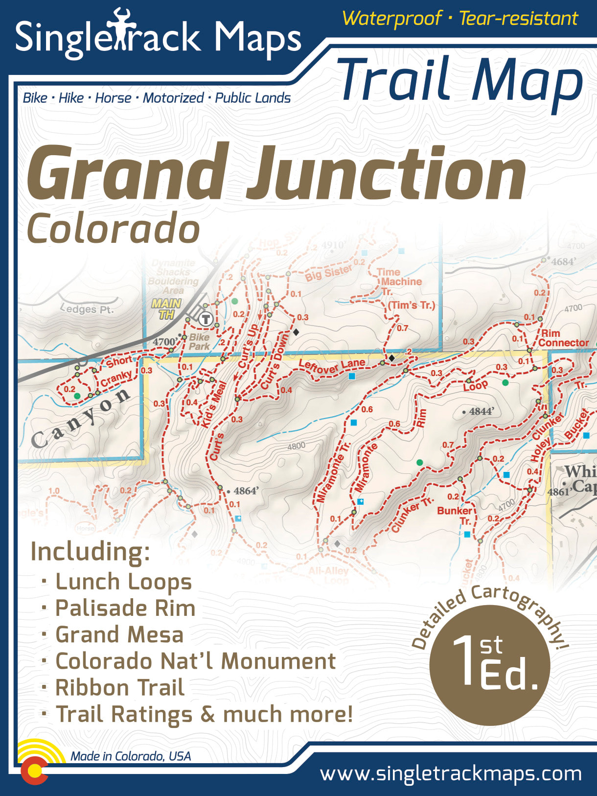
Grand Junction Trail Map
SKU:
$0.00
per item
***** CURENTLY OUT OF STOCK *****
***** CURENTLY OUT OF STOCK *****
***** CURENTLY OUT OF STOCK *****
UPDATED MAP COMING SOON!
AVAILABLE AT LOCAL SHOPS (contact us for details)
Designed for Hike, bike, horse, motorized, public lands, camping & more...
Printed on waterproof & tear resistant paper for rugged toughness!
Map Details:
- Trail Information and Ratings: Easy, Medium, Difficult
- Detailed Contour Lines.
- Measures 4” x 5.5” folded and 16” x 22” fully open
- 1st Edition - Printed in March 2018
Please note that this 1st Edition maps does NOT show The Palisade Plunge.
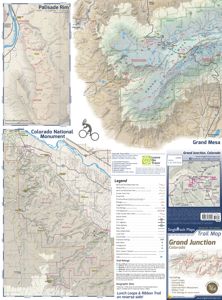
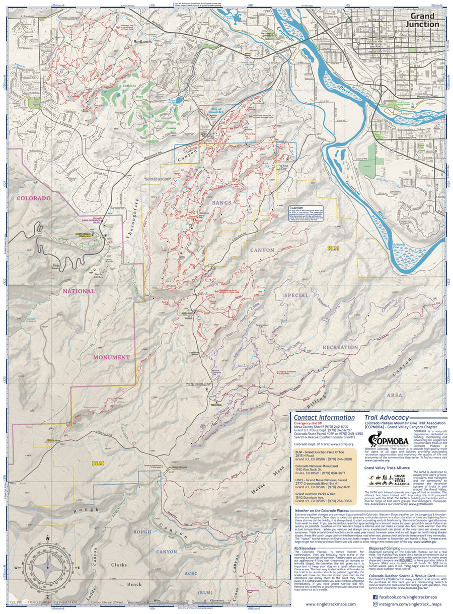
Map Includes:
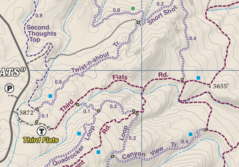
- Lunch Loops • The Ribbon Trail • Third Flats • Gunny Loop • Butterknife Trail • Colorado National Monument • Palisade Rim Trail • Grand Mesa
|
|
|
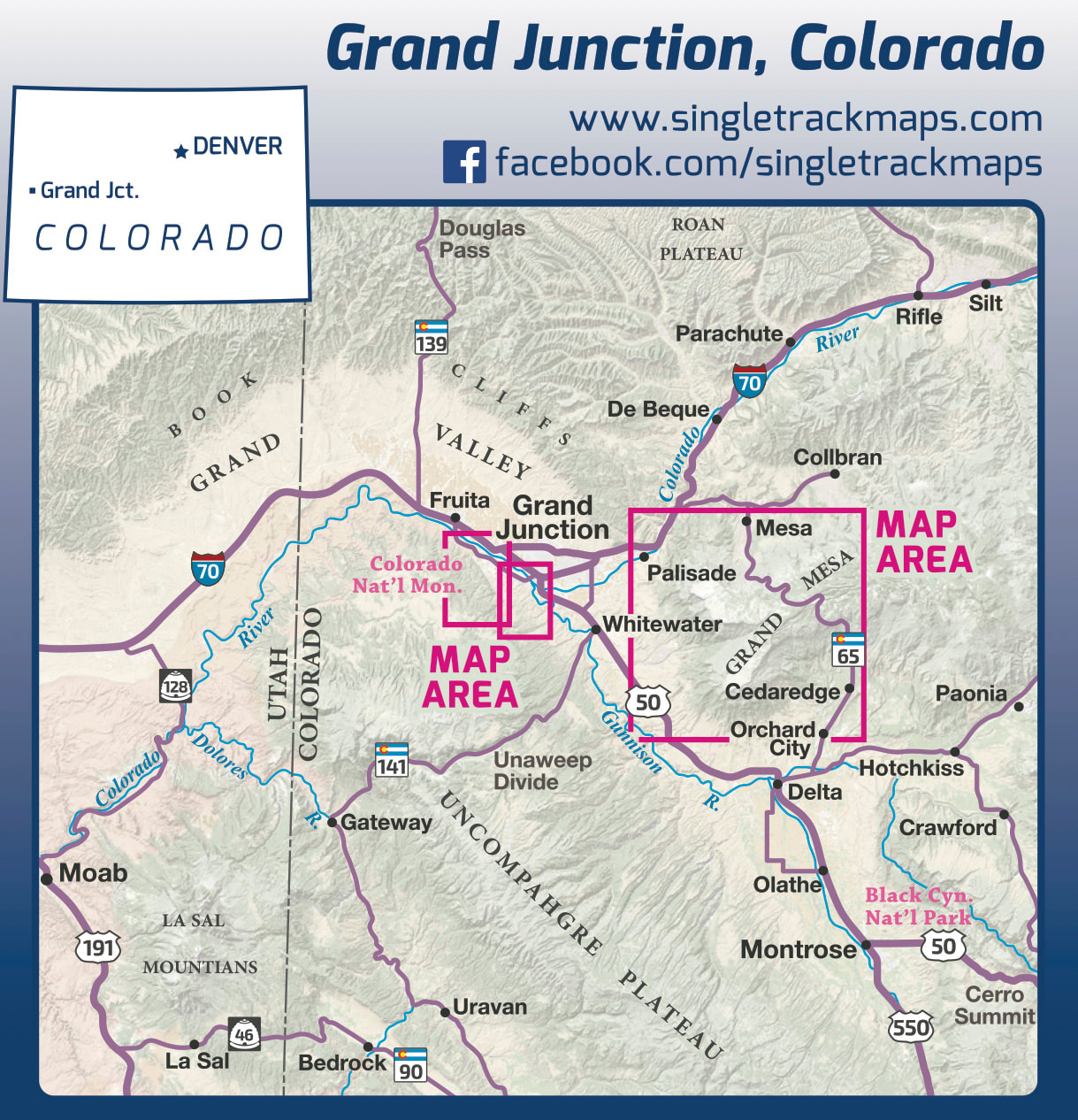
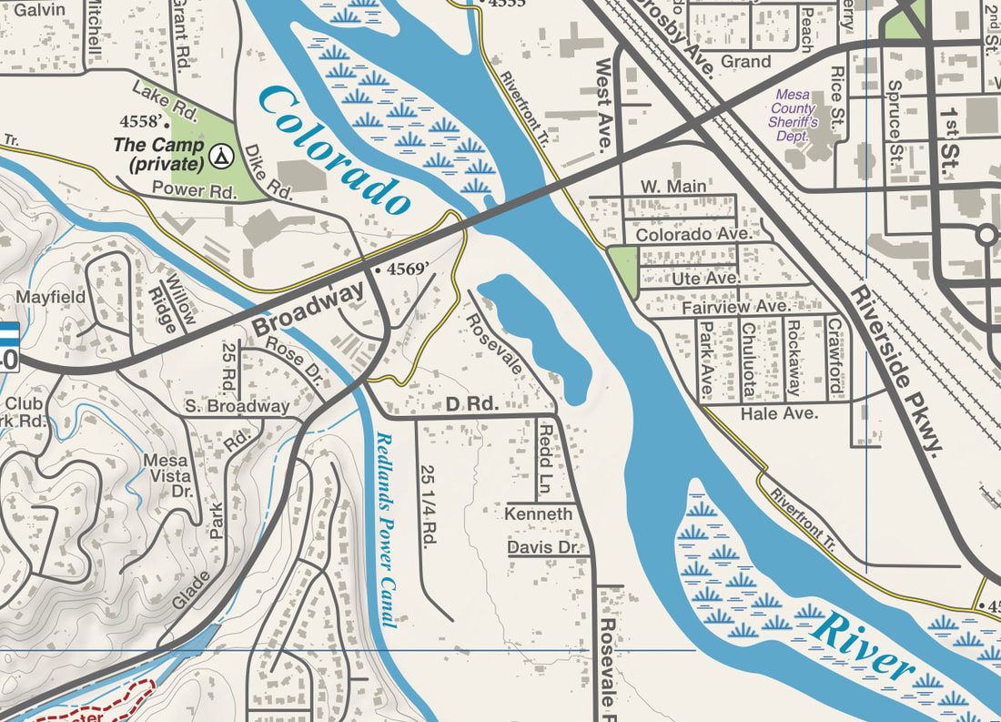
A trail map for all users
This map covers all user types from Hiking only trails, Non-Motorized Multi-Use trails, Motorized Multi-Use trails to 4x4 trails. This map is NOT just for mountain bikers we love to hike too and we spent a great amount of time gathering data on hiking only trails and 4 wheel drive trails around GJ. |
|
Beautiful Cartography!
Cartography is a craft and we have taken an enormous effort to create a beautiful map that clearly displays Grand Junction trails. |
|

