Singletrack Maps
  • Trail Maps
    • Salida & Buena Vista Trail Map
    • Hartman Rocks Trail Map
    • Crested Butte Trail Map
    • Durango Trail Map
    • Phil's World Trail Map
    • Fruita Trail Map
    • Grand Junction Trail Map
    • Breckenridge Trail Map
    • Golden Trail Map
    • Buffalo Creek Trail Map
  • Map Prints
    • Salida Trail Map Print
    • Crested Butte Trail Map Print
    • Golden Trail Map Print
    • Colorado High Rockies Wall Map
  • GeoPDF Trail Maps
    • Fruita - GeoPDF
    • Grand Junction - GeoPDF
    • Breckenridge - GeoPDF
    • Golden - GeoPDF
    • Crested Butte - GeoPDF
    • Salida - GeoPDF
    • Hartman Rocks - GeoPDF
    • Buffalo Creek - GeoPDF
    • Durango - GeoPDF
    • Ft. Collins & Lyons - GeoPDF
  • Services
  • Contact Us

GEopdF Trail Maps

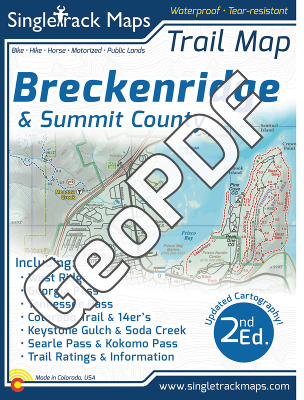
Breckenridge Trail Map - GeoPDF (iPhone, Android or Windows)

Looking for the real map? For the paper, folded, waterproof version CLICK HERE
Get the same detail of the printed Breckenridge Map in a digital PDF to use on your digital device!*
Picture

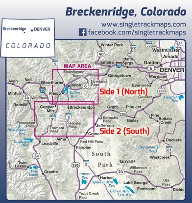
Side 1 Includes:​
  • West Ridge
  • Georgia Pass

  • ​Colorado Trail
  • Soda Creek
  • Keystone Ranch
  • Frisco Peninsula
  • Eagles Nest Wilderness

Side 2 Includes:
  • Tennessee Pass
  • Fremont Pass​
  • Searle / Kokomo
  • Camp Hale
  • Copper Mountain
  • Jefferson Creek Trail
  • Kenosha section of the CT
  • 14ers like Mt. Democrat
  • Cameron, Lincoln, Bross
  • Climax​
  • French Gulch
  • Gold Dust Trail
  • Como
Map Details:

  • Scale 1:46,250 - 1in = 0.73 Miles or 1in = 1.17 Kilometers
  • Detailed Contour Lines. Contour Interval = 40ft 
Each side is available for purchase separately.
Click on the links below for more information.
Picture
For more details on how to purchase Side 1 ($7.99) -   CLICK HERE
For more details on how to purchase Side 2 ($7.99) -  CLICK HERE
Picture
Avenza Maps is a digital app that can be downloaded for free from the App Store.
​Click here or search "Avenza Maps"

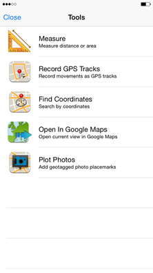
With the Singletrack Maps Breckenridge GeoPDF Map you can:
  • Use Maps Offline
  • Track Location using GPS
  • Plot Placemarks
  • Plot Photo Locations
  • Measure Distance
*This digital GeoPDF map is NOT a replacement for a printed hardcopy map. Do NOT rely on a digital device or adequate cell phone reception when traveling in the backcountry. We highly recommend you purchase the printed version. To visit the printed version page click here.


The same detail you always expect from our printed maps but in digital format on your phone. 
Singletrack Maps Breckenridge Trail Map Summit County
Picture
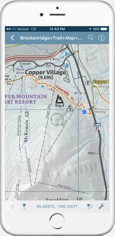
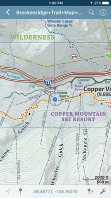
(Screen Capture - iPhone 6)
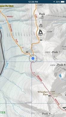
Find where you are using GPS!
Find your location using GPS
Summit County Trail Map App
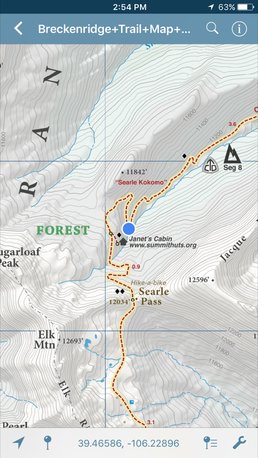
Add Placemarks.
Picture
Measure or Track using the app tools.
Picture
(Screen Capture - iPhone 6)

Picture
Picture
Picture
© 2022 Singletrack Maps, LLC • All Rights Reserved.