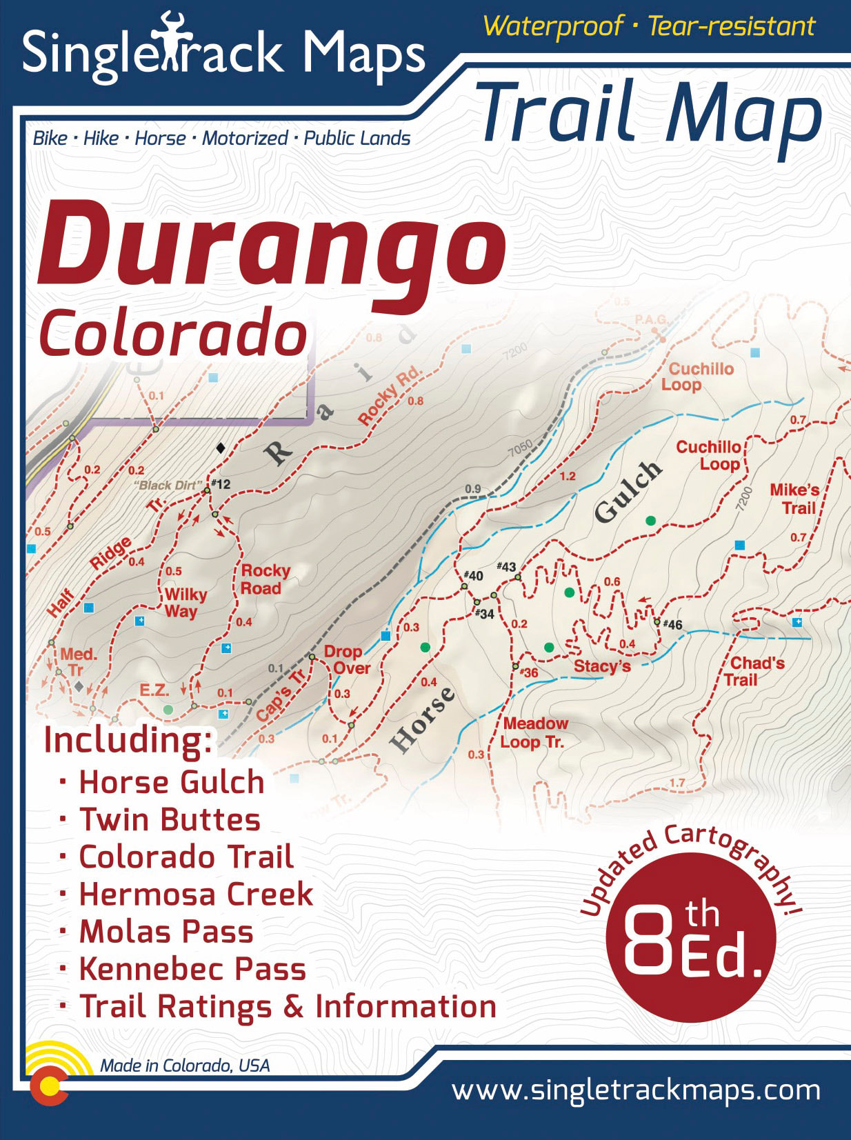
Singletrack Maps
  • Trail Maps
    • Salida & Buena Vista Trail Map
    • Hartman Rocks Trail Map
    • Crested Butte Trail Map
    • Durango Trail Map
    • Phil's World Trail Map
    • Fruita Trail Map
    • Grand Junction Trail Map
    • Breckenridge Trail Map
    • Golden Trail Map
    • Buffalo Creek Trail Map
  • Map Prints
    • Salida Trail Map Print
    • Crested Butte Trail Map Print
    • Golden Trail Map Print
    • Colorado High Rockies
  • GeoPDF Trail Maps
    • Fruita - GeoPDF
    • Grand Junction - GeoPDF
    • Breckenridge - GeoPDF
    • Golden - GeoPDF
    • Crested Butte - GeoPDF
    • Salida - GeoPDF
    • Hartman Rocks - GeoPDF
    • Buffalo Creek - GeoPDF
    • Durango - GeoPDF
    • Ft. Collins & Lyons - GeoPDF
  • Services
  • Contact Us

Durango Trail Map

SKU:
$0.00
Unavailable
per item

****** CURRENTLY UNAVAILABLE ONLINE ******

Buy at a local retailer...


Maria's Bookshop - Durango

Durango Outdoor Exchange - Durango


___________________________________________________


Designed for Hike, bike, horse, motorized, public lands, camping & more...

Printed on waterproof & tear resistant paper for rugged toughness!


​Map Details:

  • Trail Information and Ratings: Easy, Medium, Difficult
  • Scale 1:37,382 - 1in = 0.6 Miles or 1in = 0.95 Kilometers
  • Detailed Contour Lines. Contour Interval = 40ft  
  • Measures 4” x 5.5” folded and 36.5” x 22” fully open
  • 8th Edition - Printed in May 2022 (This map does NOT show the new Durango Mesa Trails aka Durango Bike Park).
Add to Cart
Map Includes:
  • Horse Gulch

  • Telegraph Trails

  • Animas City Mountain

  • Dalla Mountain Park

  • Animas River Trail

  • Twin Buttes Trails
  • Overend Mtn Park
​  a.k.a. "Test Tracks"
  • Dry Fork & Hoffheins Loop
  • Church Camp Trails

  • Log Chutes

  • Lake Nighthorse

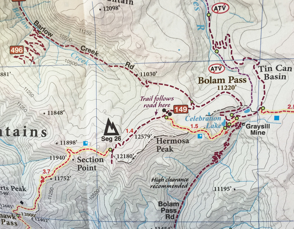
High Country areas like
  • Molas Pass
  • Kennebec Pass
  • Bolam Pass
  • Hermosa Creek
  • Colorado Trail 
The Colorado Trail.  Molas Pass to Durango
   “Molas” - Molas Pass to Bolam Pass - Seg. 25
   “Blackhawk” - Bolam Pass to Hotel Draw Rd - Seg. 26
   “Highline” - Hotel Draw Rd to Kennebec Pass - Seg. 27
   “Sliderock” - Kennebec Pass to Junction Creek - Seg. 28​
Picture
​Ride Stats & Trail Notes
Quick statistics on local rides. Showing mileage & kilometers. 
Elevation gain / loss. Trail notes like Hike-A-Bike sections and 
other notes.
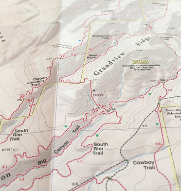
Detailed
We have spent years collecting geographic data and using local knowledge to give you the most detailed cartography for Durango & the surrounding mountains. Lots of the information and geographic knowledge on this map can't be found on any other maps!
Picture
Picture
Picture
© 2023 Singletrack Maps, LLC • All Rights Reserved.