
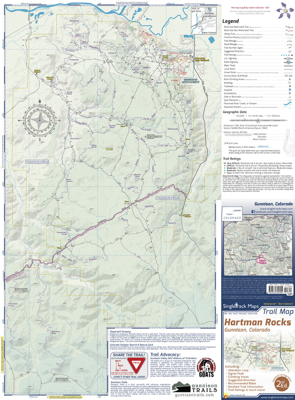
Hartman Rocks Trail Map
SKU:
$0.00
per item
***** CURENTLY OUT OF STOCK *****
***** CURENTLY OUT OF STOCK *****
***** CURENTLY OUT OF STOCK *****
UPDATED MAP COMING SOON!
AVAILABLE AT LOCAL SHOPS (contact us for details)
Designed for Hike, bike, horse, motorized, public lands, camping & more...
Printed on waterproof & tear resistant paper for rugged toughness!
Map Details:
- Trail Information and Ratings: Easy, Medium, Difficult
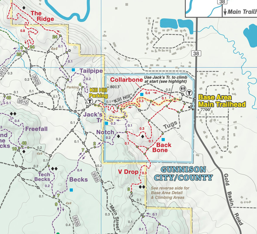
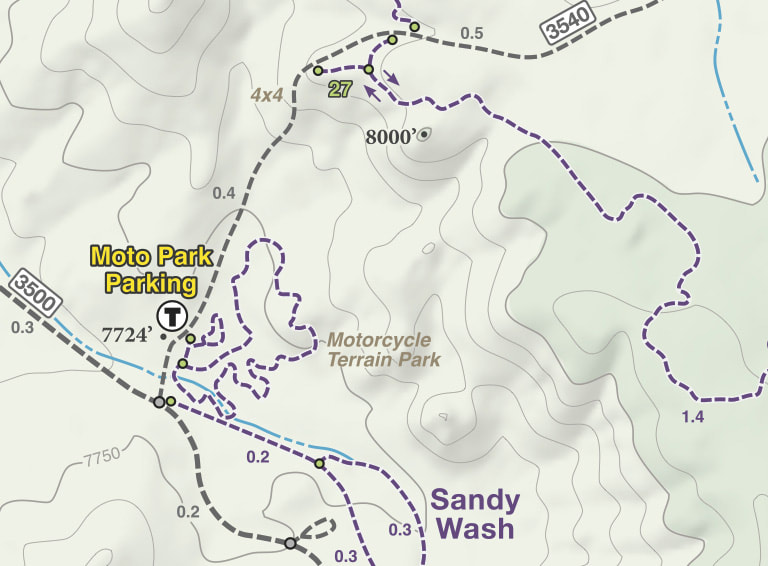
- Detailed Contour Lines.
- Measures 4” x 5.5” folded and 16” x 22” fully open
- 2nd Edition - Printed in March 2018
|
The Hartman Rocks Recreation Area is located directly south of Gunnison in the Central Colorado Rockies. This area is a mecca for all types of recreation and is still one of Colorado’s last hidden gems! If you’ve always just passed through Gunnsion on your way to the world-renowned trails in Crested Butte do yourself a favor and stop to ride at Hartman Rocks. This trail system absolutely ROCKS!
|
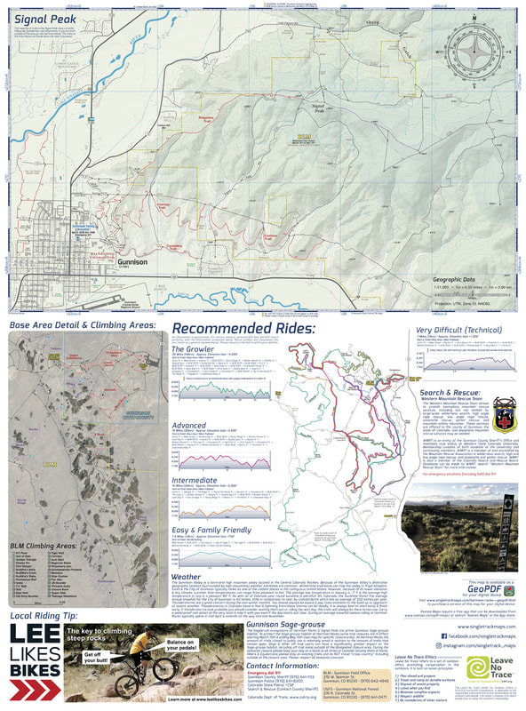
Map Includes:
|
See the Whole Picture
Stop staring at that tiny phone screen & see the entire landscape in one glance on this map! Beautiful and accurate cartography gives you the "big picture" view without having to scroll around on a 4" digital screen.
Stop staring at that tiny phone screen & see the entire landscape in one glance on this map! Beautiful and accurate cartography gives you the "big picture" view without having to scroll around on a 4" digital screen.
|
|
|
Detailed
We have spent years collecting geographic data and using local knowledge to give you the most detailed cartography for Hartman Rocks & Gunnison. |
|
A trail map for all users
This map covers all user types from Hiking only trails, Non-Motorized Multi-Use trails, Motorized Multi-Use trails to 4x4 trails. This map is NOT just for mountain bikers we love to hike too and we spent a great amount of time gathering data on hiking only trails and 4 wheel drive trails. |
|

