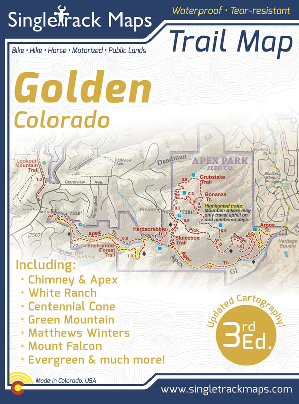
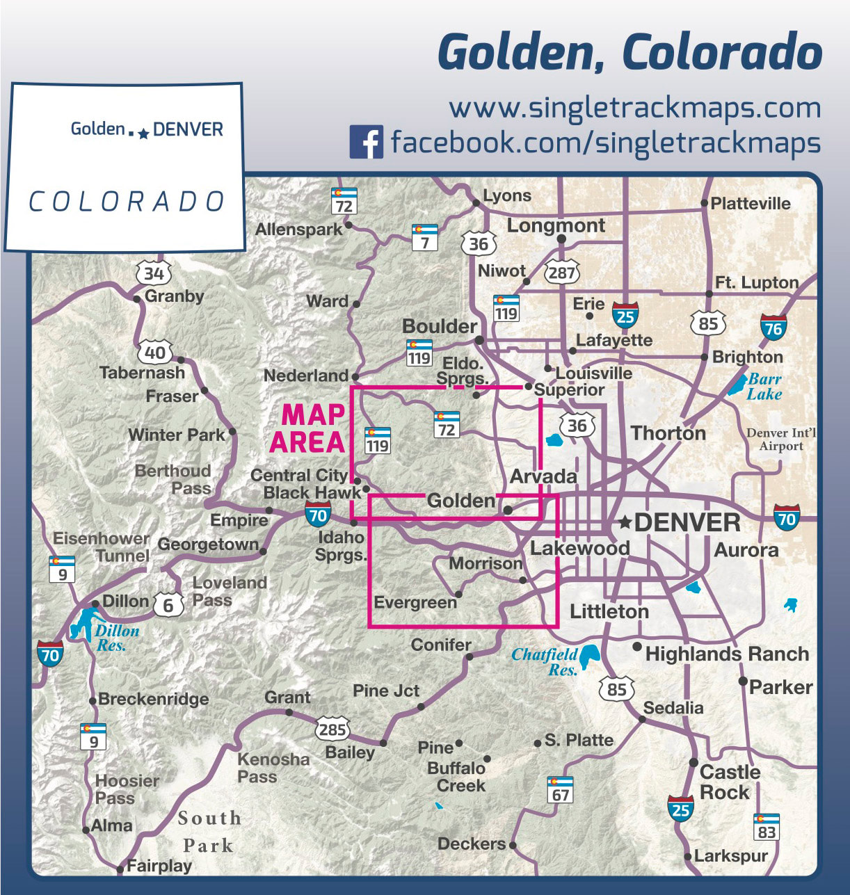
Singletrack Maps
  • Trail Maps
    • Salida & Buena Vista Trail Map
    • Hartman Rocks Trail Map
    • Crested Butte Trail Map
    • Durango Trail Map
    • Phil's World Trail Map
    • Fruita Trail Map
    • Grand Junction Trail Map
    • Breckenridge Trail Map
    • Golden Trail Map
    • Buffalo Creek Trail Map
  • Map Prints
    • Salida Trail Map Print
    • Crested Butte Trail Map Print
    • Golden Trail Map Print
    • Colorado High Rockies Wall Map
  • GeoPDF Trail Maps
    • Fruita - GeoPDF
    • Grand Junction - GeoPDF
    • Breckenridge - GeoPDF
    • Golden - GeoPDF
    • Crested Butte - GeoPDF
    • Salida - GeoPDF
    • Hartman Rocks - GeoPDF
    • Buffalo Creek - GeoPDF
    • Durango - GeoPDF
    • Ft. Collins & Lyons - GeoPDF
  • Services
  • Contact Us

Golden Trail Map

SKU:
$0.00
Unavailable
per item

***** CURENTLY OUT OF STOCK *****

***** CURENTLY OUT OF STOCK *****

***** CURENTLY OUT OF STOCK *****


AVAILABLE AT LOCAL SHOPS (contact us for details)


Free USPS Shipping on all Trail Map orders!


Designed for Hike, bike, horse, motorized, public lands, camping & more...


Printed on waterproof & tear resistant paper for rugged toughness!


Map Details:

  • Trail Information and Ratings: Easy, Medium, Difficult
  • Scale 1:40,000 - 1in = 0.62 Miles or 1in = 1 Kilometers
  • Detailed Contour Lines. Contour Interval = 40ft  
  • Measures 4” x 5.5” folded and 36” x 22” fully open
  • 3rd Edition - Printed in July 2018
Add to Cart
​Map Includes:
  • Chimney  Gulch

  • Apex Park

  • North Table Mountain
  • South Table Mountain
  • Mount Galbraith
  • White Ranch
  • Centennial Cone
  • Golden Gate State Park
  • Eldorado Canyon S.P.
  • Rocky Flats N.W.R
  • S. Boulder trails like, High Plains Trail, Coalton Trail, Flatirons Vista, Doudy Draw, Spring Brook, Fowler, Goshawk Ridge
​
  • Green Mountain
  • Dakota Ridge
  • Matthews Winters
  • Red Rocks Park
  • Bear Creek Lake Park
  • Mount Falcon
  • Lair O' The Bear
  • O'Fallon Park
  • Alderfer Three Sisters
  • Elk Meadow
  • Genesse Park
  • Evergreen 
             and much more!
​Also Includes;
  • Trail Mileage
  • Ride Descriptions for the best Golden rides​ (with profiles)
  • Detailed Roads
  • Campground Information
  • Public Land Boundaries
Beautiful Cartography!
Cartography is a craft and we have taken an enormous effort to create a beautiful map that clearly displays Golden & the surrounding area.
​Detailed
We have spent years collecting geographic data and using local knowledge to give you the most detailed cartography for Golden & the surrounding mountains. Lots of the information and geographic knowledge on this map can't be found on any other maps!
Picture
Picture
© 2023 Singletrack Maps, LLC • All Rights Reserved.