Singletrack Maps
  • Trail Maps
    • Salida & Buena Vista Trail Map
    • Hartman Rocks Trail Map
    • Crested Butte Trail Map
    • Durango Trail Map
    • Phil's World Trail Map
    • Fruita Trail Map
    • Grand Junction Trail Map
    • Breckenridge Trail Map
    • Golden Trail Map
    • Buffalo Creek Trail Map
  • Map Prints
    • Salida Trail Map Print
    • Crested Butte Trail Map Print
    • Golden Trail Map Print
    • Colorado High Rockies Wall Map
  • GeoPDF Trail Maps
    • Fruita - GeoPDF
    • Grand Junction - GeoPDF
    • Breckenridge - GeoPDF
    • Golden - GeoPDF
    • Crested Butte - GeoPDF
    • Salida - GeoPDF
    • Hartman Rocks - GeoPDF
    • Buffalo Creek - GeoPDF
    • Durango - GeoPDF
    • Ft. Collins & Lyons - GeoPDF
  • Services
  • Contact Us

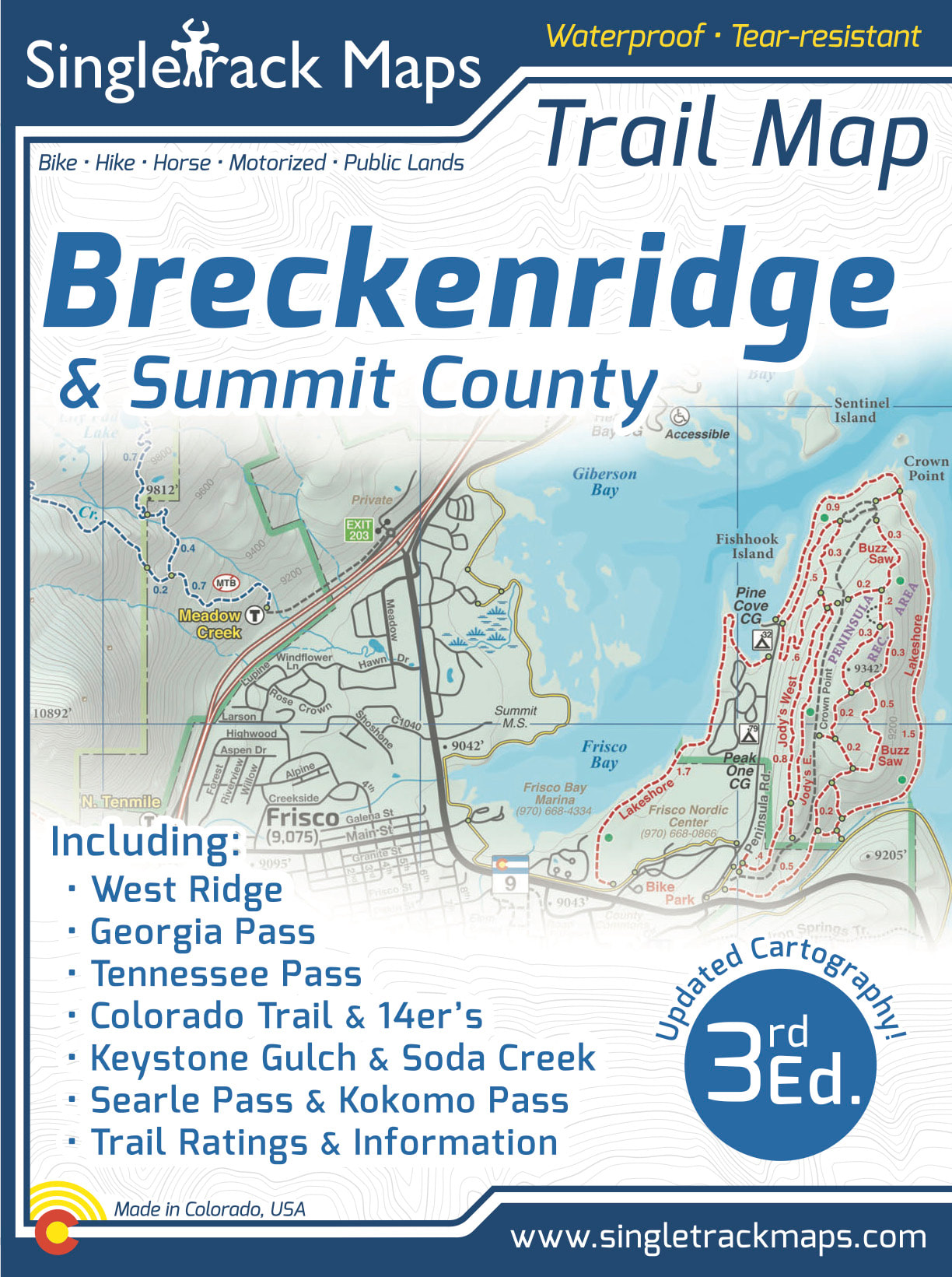
Breckenridge Trail Map (Summit County)

SKU:
$16.99
$16.99
Unavailable
per item

Free USPS Shipping on all Trail Map orders!


Designed for Hike, bike, horse, motorized, public lands, camping & more...


Printed on waterproof & tear resistant paper for rugged toughness!


Map Details:

  • Trail Information and Ratings: Easy, Medium, Difficult
  • Scale 1:46,250 - 1in = 0.73 Miles or 1in = 1.17 Kilometers
  • Detailed Contour Lines. Contour Interval = 40ft  
  • Measures 4” x 5.5” folded and 36” x 22” fully open
  • 3rd Edition - Printed in July 2021
Add to Cart
​Map Includes:
  • West Ridge
  • Georgia Pass

  • Jefferson Creek Trail
  • Kenosha section of the CT
  • Colorado Trail
  • Soda Creek
  • Keystone Ranch
  • Frisco Peninsula
  • Eagles Nest Wilderness
  • Copper Mountain
  • Searle / Kokomo

​​
  • Camp Hale
  • Tennessee Pass
  • Fremont Pass
  • 14ers like Mt. Democrat
  • Cameron, Lincoln, Bross
  • Climax
  • Tenmile Range
  • Breckenridge
  • French Gulch
  • Gold Dust Trail
  • Como
             and much more!
Also Includes;
  • Trail Mileage
  • Detailed Roads
  • Campground Information
  • Public Land Boundaries
Singletrack Maps Breckenridge Trail Map
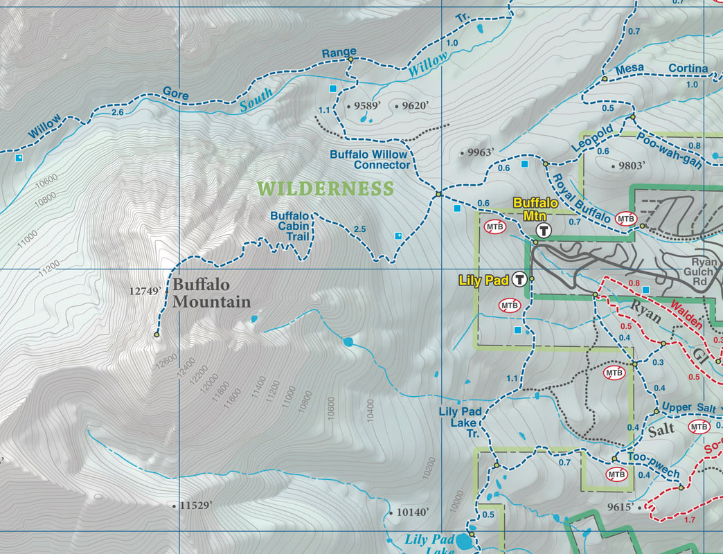
Beautiful Cartography!
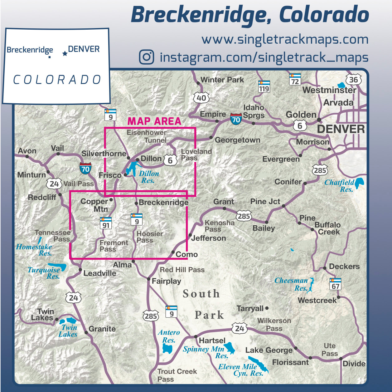
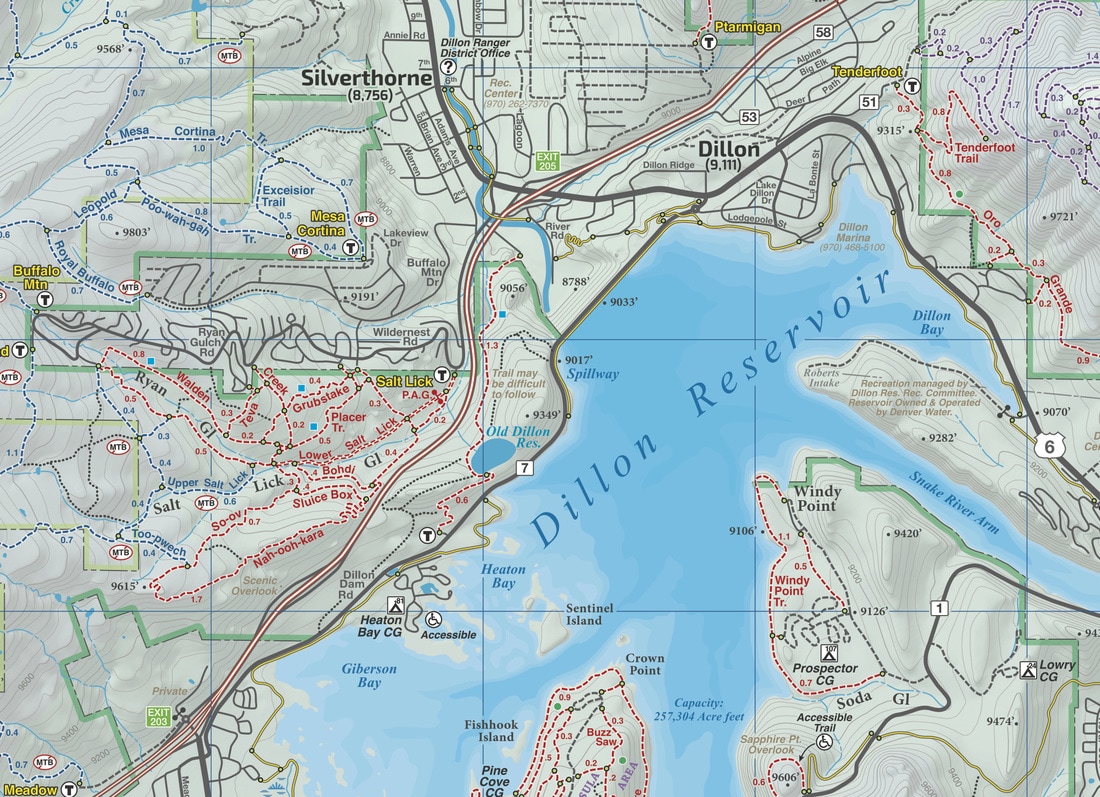
Cartography is a craft and we have taken an enormous effort to create a beautiful map that clearly displays Breckenridge & Summit County.
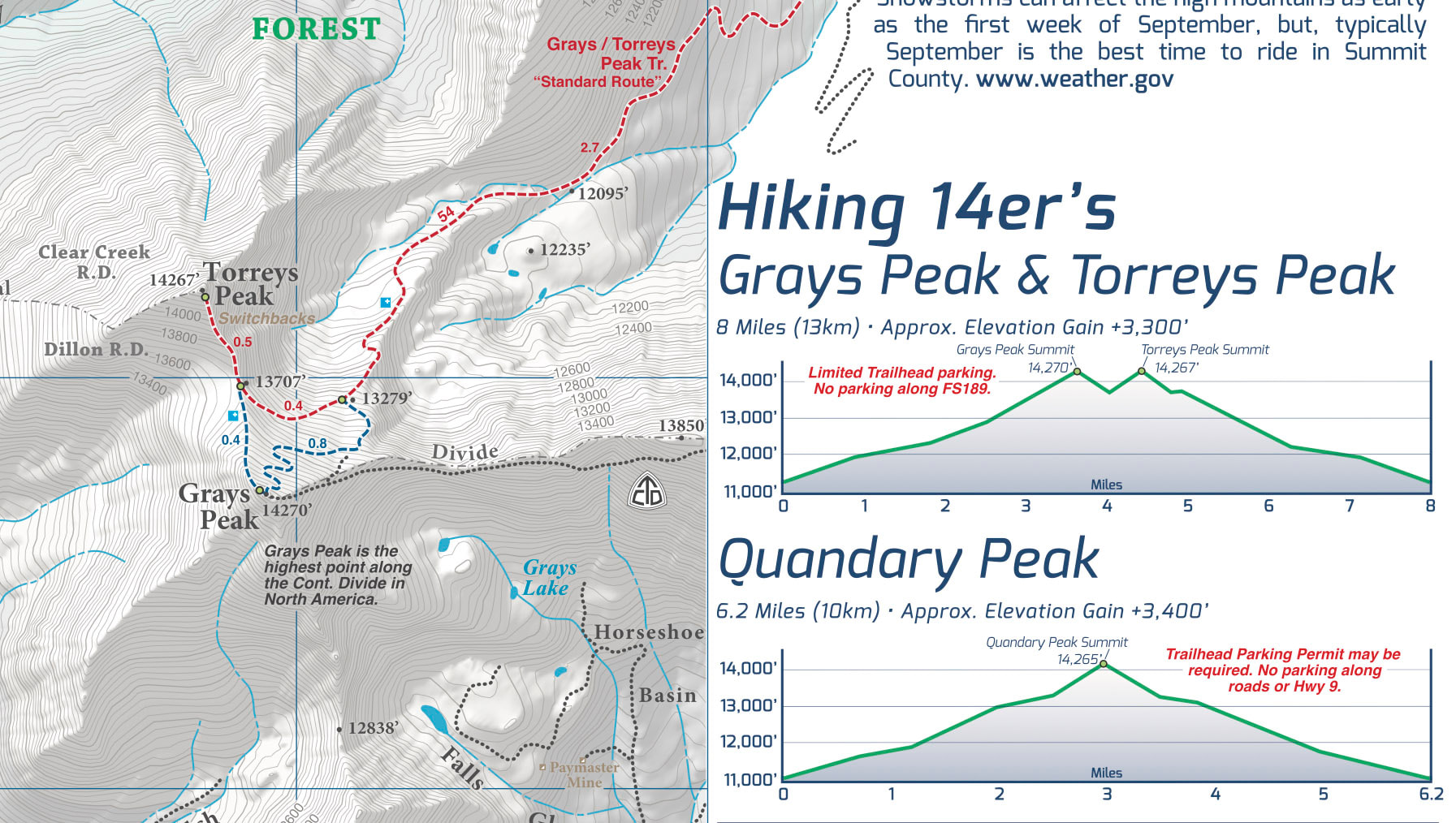
Trail Information
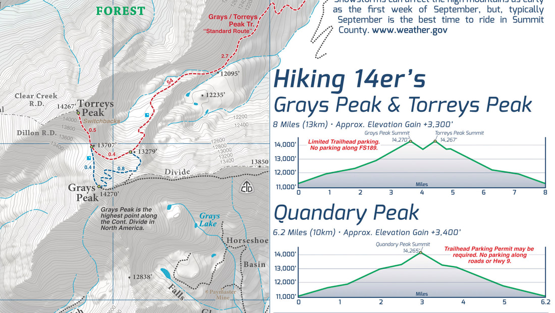
A trail information panel is  included on the map. This information panel describe three of the most popular local trail rides & include specific stats like mileage and elevation gain / loss.Trail information is also included about Summit County's popular 14er's.

The side panel also includes information about campgrounds, local agencies and weather.
Picture
Picture
​A trail map for all users
This map covers all user types from Hiking only trails, Non-Motorized Multi-Use trails, Motorized Multi-Use trails to 4x4 trails. This map is NOT just for mountain bikers we love to hike too and we spent a great amount of time gathering data on hiking only trails and 4 wheel drive trails in Summit County.
Picture
Picture
© 2023 Singletrack Maps, LLC • All Rights Reserved.