Singletrack Maps
  • Trail Maps
    • Salida & Buena Vista Trail Map
    • Hartman Rocks Trail Map
    • Crested Butte Trail Map
    • Durango Trail Map
    • Phil's World Trail Map
    • Fruita Trail Map
    • Grand Junction Trail Map
    • Breckenridge Trail Map
    • Golden Trail Map
    • Buffalo Creek Trail Map
  • Map Prints
    • Salida Trail Map Print
    • Crested Butte Trail Map Print
    • Golden Trail Map Print
    • Colorado High Rockies
  • GeoPDF Trail Maps
    • Fruita - GeoPDF
    • Grand Junction - GeoPDF
    • Breckenridge - GeoPDF
    • Golden - GeoPDF
    • Crested Butte - GeoPDF
    • Salida - GeoPDF
    • Hartman Rocks - GeoPDF
    • Buffalo Creek - GeoPDF
    • Durango - GeoPDF
    • Ft. Collins & Lyons - GeoPDF
  • Services
  • Contact Us

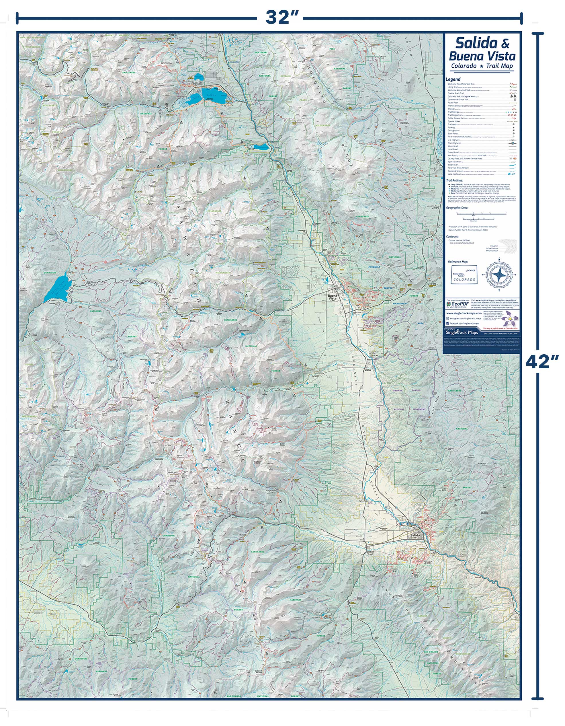
Salida & Buena Vista Map Print

SKU:
$0.00
Unavailable
per item

****** CURRENTLY UNAVAILABLE (Please check back later) ******


-Printing on heavy duty laminate paper (front laminate)

-Shipping via UPS Ground (to residential)

-Packaging and Handling (Map tube & secure wrapping)

-Sales Tax


Measures 32" x 42” (width, height) 


We took everything that is great about our folded Salida & BV Trail Map and combined the front & back to one full page.


Hang it in your house, office, or garage.


A unique cartographic print & a must have for anyone that loves Salida, Buena Vista and the Collegiate Peaks!

Add to Cart
Free shipping via UPS Ground. Map is shipped rolled in a tube.           For information about framing or mounting options please Contact Us

Details:
• 32” x 42” (width, height)
• Updated regularly

• Printed on high quality paper.
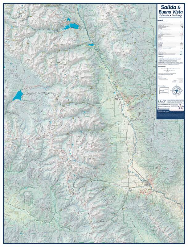
​Displays:
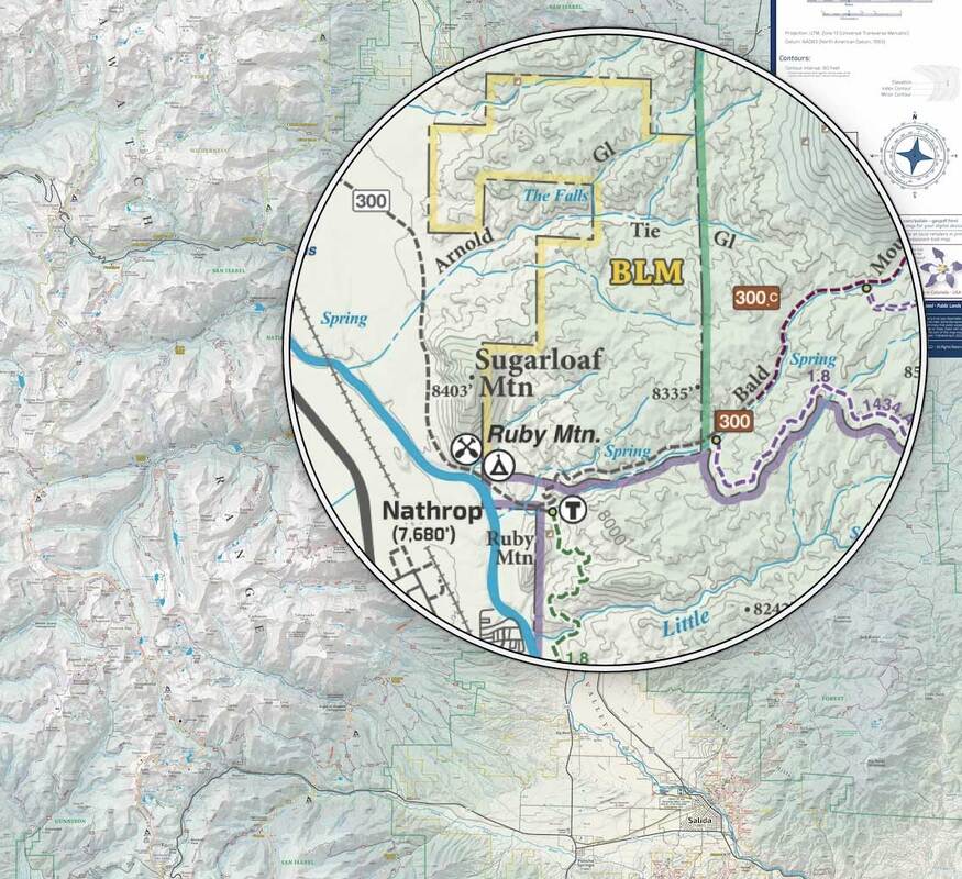
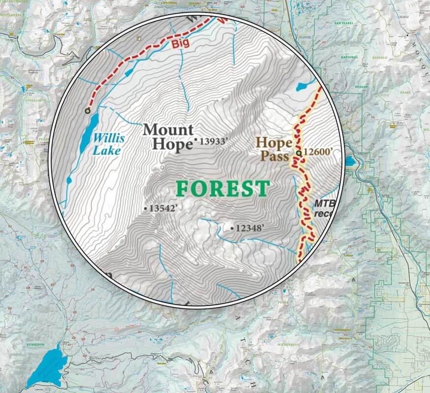
• Trails (Multi-Use, Motorized  & Hiking only)
• Jeep Roads
• Public Highways and Local Roads
• Public Land Boundaries (USFS, Wilderness, BLM)
• Hydrography
• Detailed Contour Lines & Much More!
Boundaries:​
North:  Mount Elbert / Independence Pass
South: Silver Creek Trail / Long Branch Baldy
East: Howard / U.S. Hwy 285
West: Taylor Park Reservoir / Ohio City
Picture
Detailed
​Trails are colored for different user types
Picture
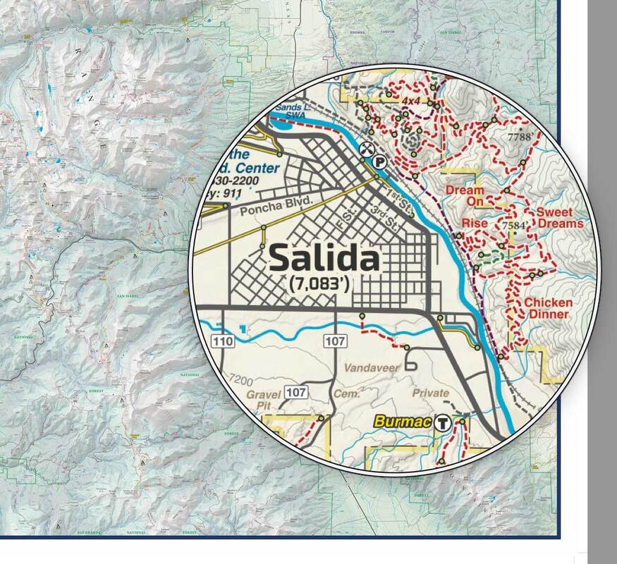
Public Land Boundaries like USFS, BLM, & Wilderness.
Picture
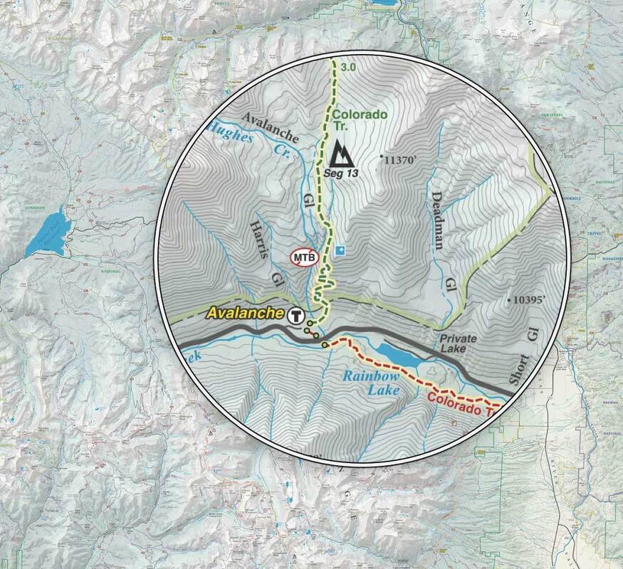
Detailed Contour Lines & Hypsometric Shading
Picture
Picture
Picture
Picture
© 2023 Singletrack Maps, LLC • All Rights Reserved.