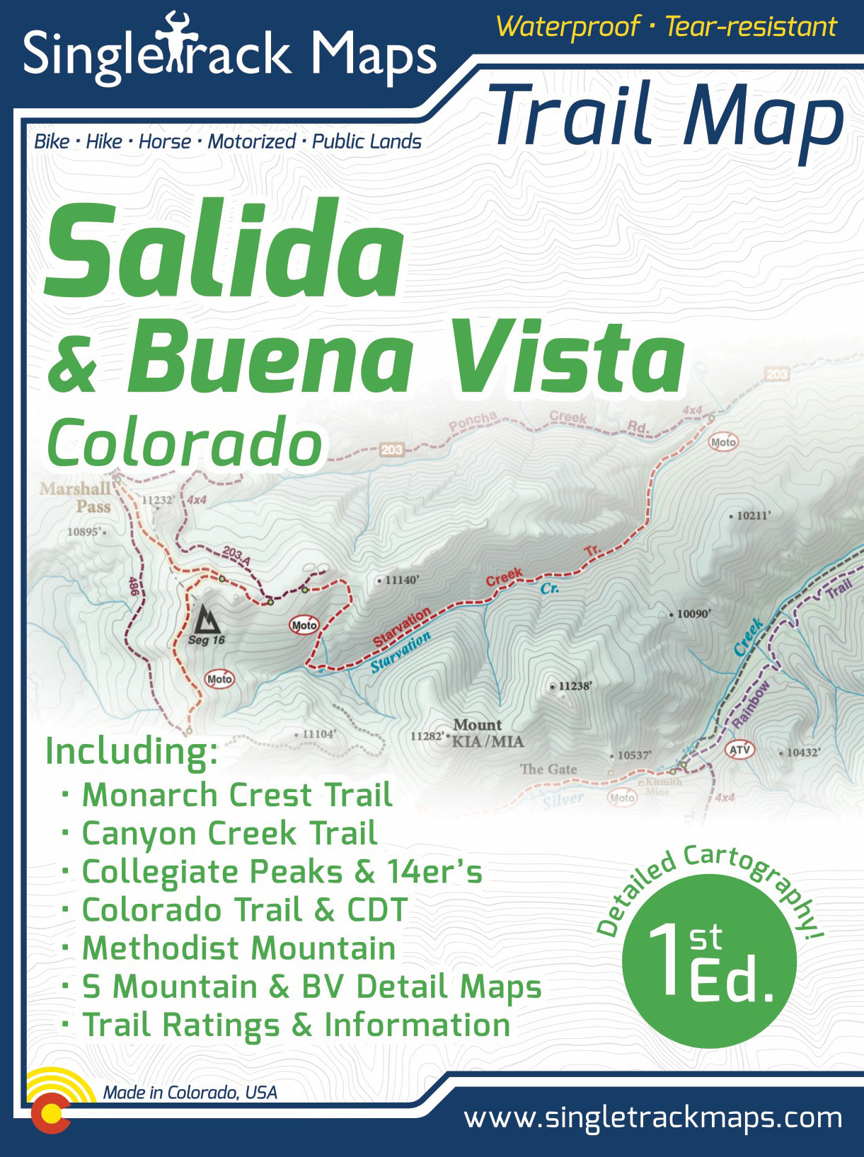

Salida & Buena Vista Trail Map
SKU:
$16.99
$16.99
per item
Designed for Hike, bike, horse, motorized, public lands, camping & more...
Printed on waterproof & tear resistant paper for rugged toughness!
Map Details:
- Trail Information and Ratings: Easy, Medium, Difficult
- Scale 1:90,000 - 1in = 1.42 Miles or 1in = 2.2 Kilometers
- Detailed Contour Lines. Contour Interval = 80ft
- Measures 4” x 5.5” folded and 36” x 22” fully open
- 1st Edition - Printed in May 2022
|
Map Includes:
|
|

|
Field Checked & Accurate!
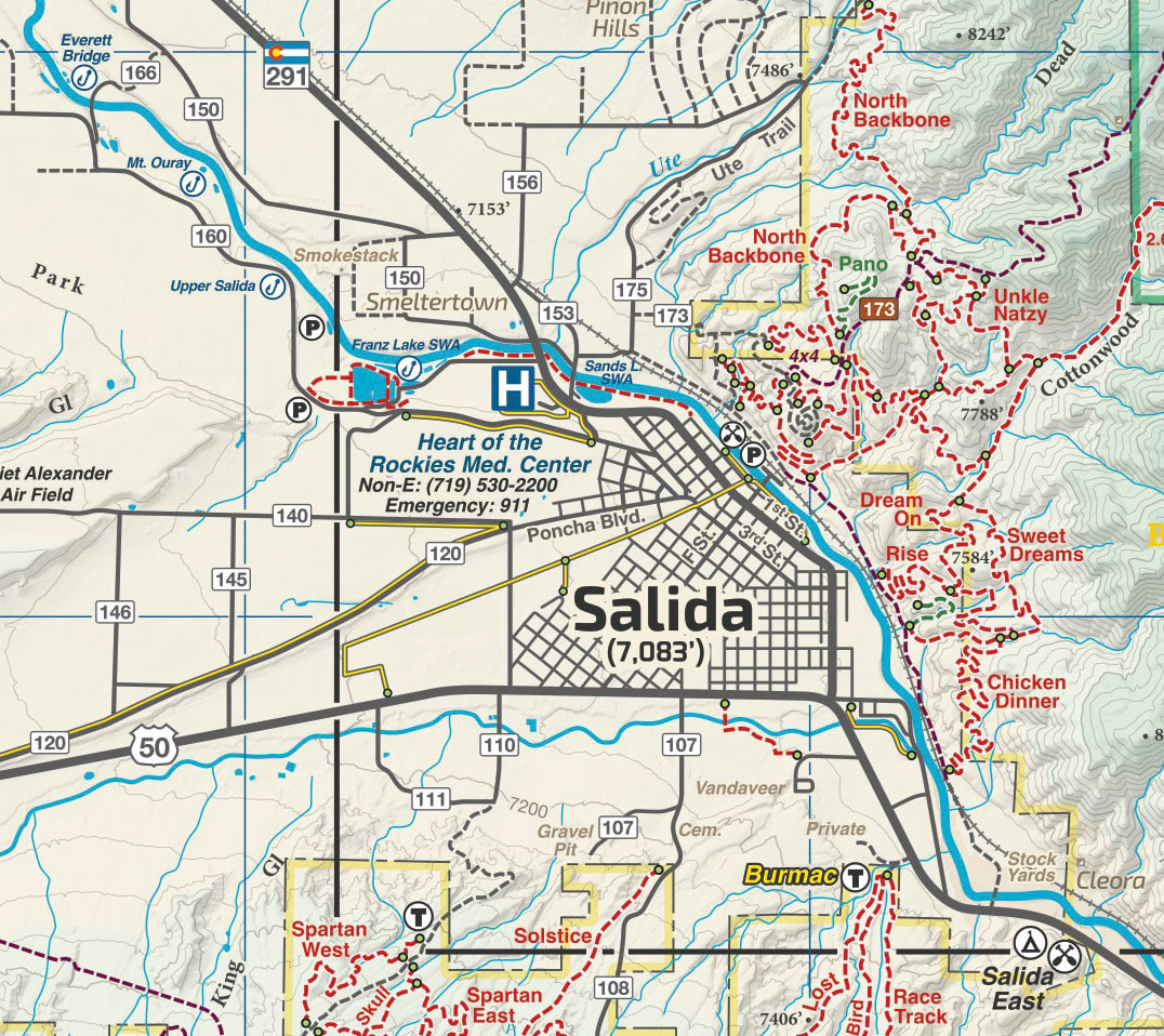
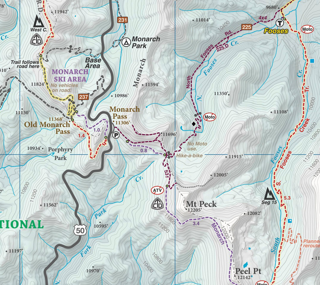
Field checked cartography for the most accurate and up-to-date map available! We don’t rely on other parties for our data, we get outside and collect our own trail and geographic data |
|
Detailed
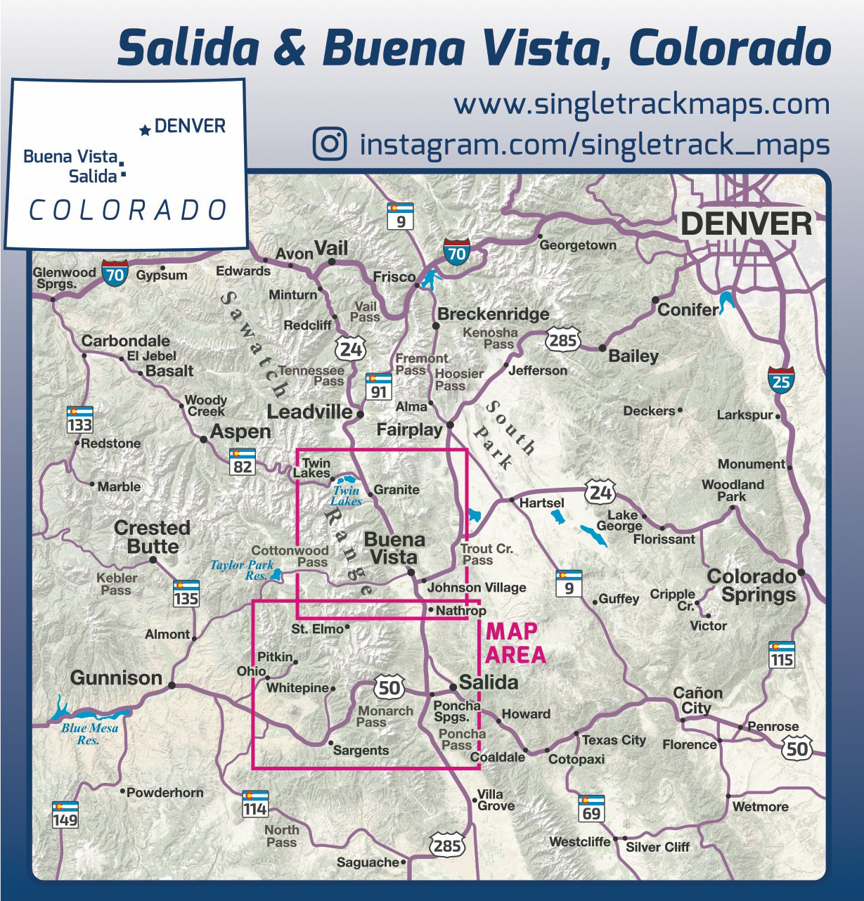
We have spent years collecting geographic data and using local knowledge to give you the most detailed cartography for Salida, Buena Vista and the surrounding Sawatch Range. Lots of the information and geographic knowledge on this map can't be found on any other maps! |
|
|
See the Whole Picture
Stop staring at that tiny phone screen & see the entire landscape in one glance on this map! Beautiful and accurate cartography gives you the "big picture" view without having to scroll around on a 4" digital screen. No batteries or power required, ever! |
|
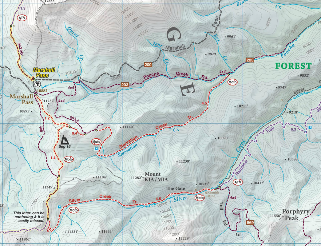
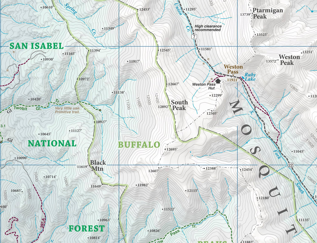
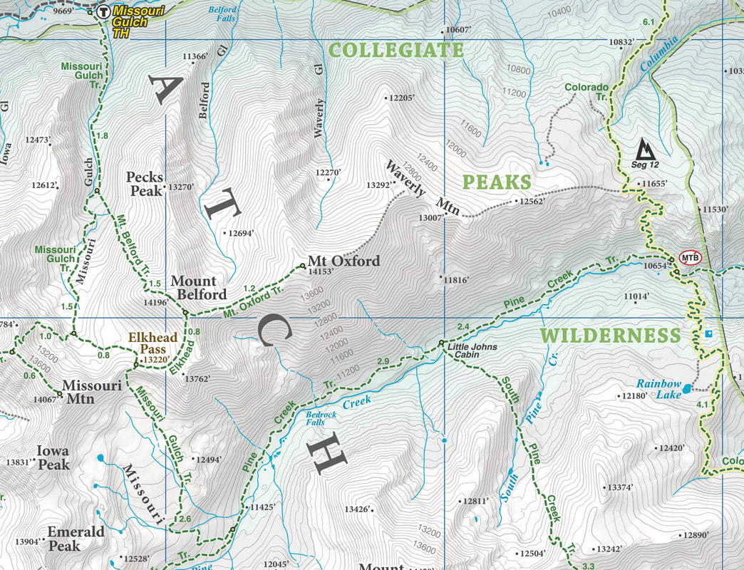
Trail Information
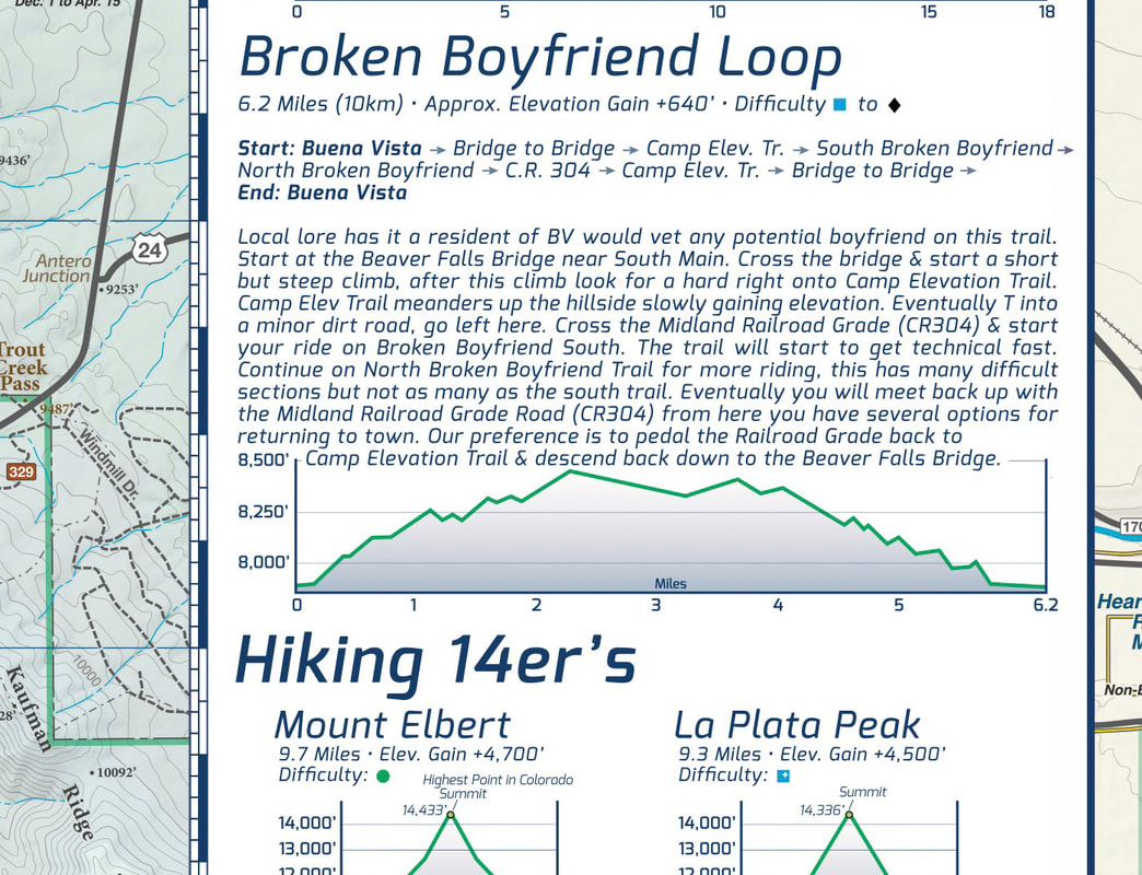
A trail information panel is included on the map. This information panel describe many of the most popular local trail rides & include specific stats like mileage and elevation gain / loss. Trail profiles information is also included about the Sawatch Range 14er's. The side panel also includes information about campgrounds, local agencies and weather. |
|
|
A trail map for all users
This map covers all user types from Hiking only trails, Non-Motorized Multi-Use trails, Motorized Multi-Use trails to 4x4 trails. This map is NOT just for mountain bikers we love to hike too and we spent a great amount of time gathering data on hiking only trails and 4 wheel drive trails in Chaffee County. |
Local
Made in Colorado! From the cartography to the final printing. Every step takes place in Colorado. Buy Local!
Made in Colorado! From the cartography to the final printing. Every step takes place in Colorado. Buy Local!

