Singletrack Maps
  • Trail Maps
    • Salida & Buena Vista Trail Map
    • Hartman Rocks Trail Map
    • Crested Butte Trail Map
    • Durango Trail Map
    • Phil's World Trail Map
    • Fruita Trail Map
    • Grand Junction Trail Map
    • Breckenridge Trail Map
    • Golden Trail Map
    • Buffalo Creek Trail Map
  • Map Prints
    • Salida Trail Map Print
    • Crested Butte Trail Map Print
    • Golden Trail Map Print
    • Colorado High Rockies Wall Map
  • GeoPDF Trail Maps
    • Fruita - GeoPDF
    • Grand Junction - GeoPDF
    • Breckenridge - GeoPDF
    • Golden - GeoPDF
    • Crested Butte - GeoPDF
    • Salida - GeoPDF
    • Hartman Rocks - GeoPDF
    • Buffalo Creek - GeoPDF
    • Durango - GeoPDF
    • Ft. Collins & Lyons - GeoPDF
  • Services
  • Contact Us

Trail Maps

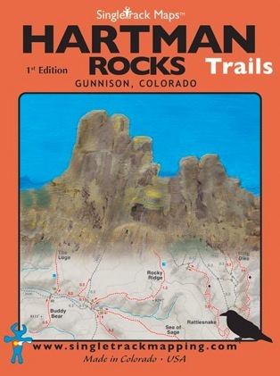
Hartman Rocks Trail Map

The Hartman Rocks Recreation Area is located directly south of Gunnison in the Central Colorado Rockies. This area is a mecca for all types of recreation and is still one of Colorado’s last hidden gems!  If you’ve always just passed through Gunnsion on your way to the world-renowned trails in Crested Butte do yourself a favor and stop to ride at Hartman Rocks. This trail system absolutely ROCKS!
Map Includes:
  • Trail mileage

  • Road mileage

  • Trail difficulty ratings

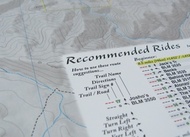
  • Recommended Rides for beginner, intermediate, advanced

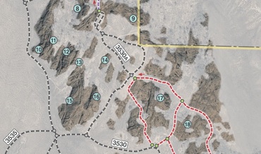
  • BLM Climbing Areas located and labeled

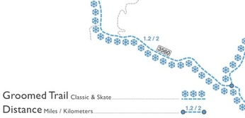
  • Winter XC Ski trails

  • Camping Information

  • Signal Peak and areas adjacent to WSCU Campus

Printed on waterproof & tear resistant paper for rugged toughness!
Map Details:
Scale 1:21,400 - 1in = 0.4 miles or 1in = 0.64 km

Contour Interval = 50 feet

Measures 4” x 5.5” folded & 16” x 22” fully open

Waterproof & tear resistant paper

1st Edition - Printed July 2013
Picture
Purchase Online - $13.99 - FREE SHIPPING!

Why our trail maps are different 

Pocket Size!
Our maps are designed to easily fit into a jersey pocket, bike shorts or just a regular pocket! No need to take your backpack off and dig out that map.
Picture
Trail Ratings
Trail segments are rated based on difficulty.  These ratings help you choose a trail to suite what you want to ride. Simple and easy to understand.
Picture
Detailed Contour Lines
Picture
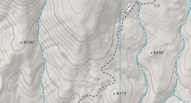
These contour lines are rendered using high resolution data from NASA and the USGS. They are further enhanced by hand to provide the greatest detail possible. Detailed contours paint a clear picture of how the local geography shapes the land. Contours on a map are super important to us as riders... How much climbing is left? How many feet are we going to descend? Clear and precise contours answer these questions.
Suggested Trail Direction
Picture
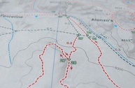
Arrows indicated the best direction to ride each trail. These are only suggestions. We encourage you to  be creative and explore!
Recommended Rides
There is lots of riding at Hartman Rocks! This map 
list recommended rides for three different skill levels; beginner, intermediate & advanced.

Picture
Winter XC Ski Trails


The Hartman Rocks Recreation Area is a great place to Cross Country Ski. Best of all and thanks to the BLM and Gunnison Nordic 
(a 501c3 non-profit), the groomed track is free and open to the public.
Picture
BLM Climbing Areas
Along with a detailed inset map of the base area trails.
Picture
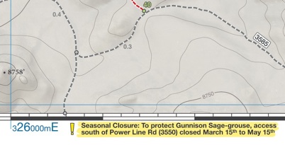
Seasonal Closure Information

Picture

Picture
Picture
Picture
© 2023 Singletrack Maps, LLC • All Rights Reserved.