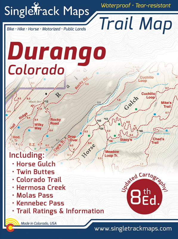
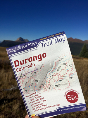
Durango Trail Map - 7th Edition
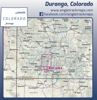
The Colorado Trail. Molas Pass to Durango
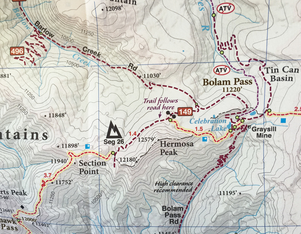
“Molas” - Molas Pass to Bolam Pass - Seg. 25 “Blackhawk” - Bolam Pass to Hotel Draw Rd - Seg. 26 “Highline” - Hotel Draw Rd to Kennebec Pass - Seg. 27 “Sliderock” - Kennebec Pass to Junction Creek - Seg. 28 Printed on waterproof & tear resistant paper for rugged toughness! Map Details:
Also Includes;
|
Purchase Online- $13.99 - Click here: Durango Trail Map
|
|
Beautiful Cartography!
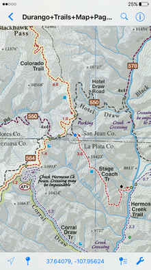
Cartography is a craft and we have taken an enormous effort to create a beautiful map that clearly displays Durango & the surrounding area. 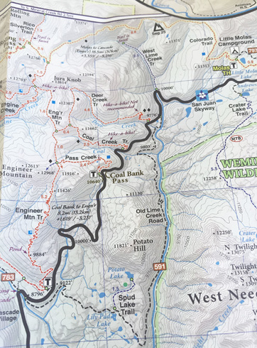
Detailed
We have spent years collecting geographic data and using local knowledge to give you the most detailed cartography for Durango & the surrounding mountains. Lots of the information and geographic knowledge on this map can't be found on any other maps! 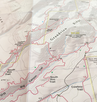
|
GeoPDF on your phone
This map is available in digital format for your phone or mobile device. Click here for more information. We do NOT recommend using digital maps only, however this GeoPDF combined with the REAL printed map is a powerful tool to locate your position.
|
Why we are different
|
Pocket Size!
Our maps are designed to easily fit into a jersey pocket, bike shorts or just a regular pocket! No need to take your backpack off and dig out that bulky map. 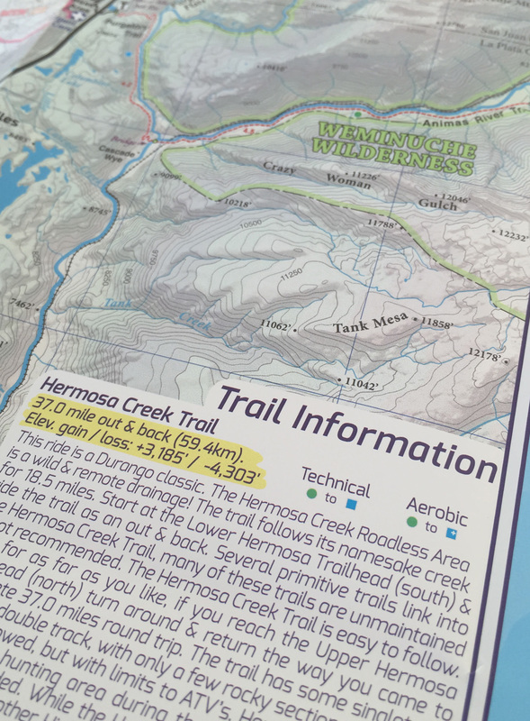
|
Trail Ratings
Trail segments are rated based on difficulty. These ratings help you choose a trail to suite what you want to ride. Simple and easy to understand. 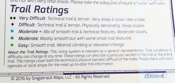
|
|
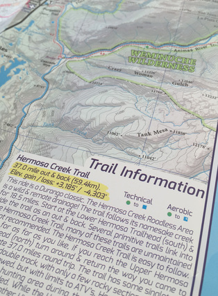
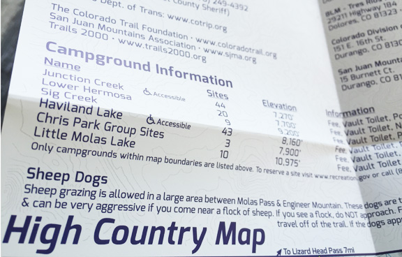
Trail Information
Trail information panels are included on each side of the map. These information panels describe the most popular local rides & include specific ride stats like mileage and elevation gain / loss. Want to plan out your ride the night before? These descriptions help you decide what to do and what to expect. Also includes important campground information! |
|
Field Checked & Accurate!
Field checked cartography for the most accurate and up-to-date map available! We don’t rely on other parties for our data, we get outside and collect our own trail and geographic data.
We are cartographers and our job is to make
the best possible map for you, the user.
We are NOT web programers putting digital overlays
onto web maps just so that we can earn money from advertising.
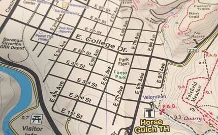
Detailed Roads
All of Durango’s roads cleanly labeled so you can navigate to the trailhead, the local shops or campgrounds.
Local Information
Outdoor shops, Bike shops & MOST importantly Microbreweries!
All of Durango’s roads cleanly labeled so you can navigate to the trailhead, the local shops or campgrounds.
Local Information
Outdoor shops, Bike shops & MOST importantly Microbreweries!
|
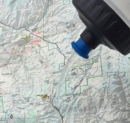
Waterproof Paper
Printed on waterproof and tear-resistant paper for rugged toughness. Doubles as an umbrella during those unexpected downpours :) |
|
|
Ride Stats & Trail Notes
Quick statistics on local rides. Showing mileage & kilometers. Elevation gain / loss. Trail notes like Hike-A-Bike sections and other notes. |
|
Important Stuff
Quickly look up emergency contact info. Side panels list contact information for various local agencies and information that you won't find on any other map! |
|
See the Whole Picture
Stop staring at that tiny phone screen & see the entire landscape in one glance on this map! Beautiful and accurate cartography gives you the "big picture" view without having to scroll around on a 4" digital screen.
Stop staring at that tiny phone screen & see the entire landscape in one glance on this map! Beautiful and accurate cartography gives you the "big picture" view without having to scroll around on a 4" digital screen.
No batteries or power required, ever! It just works.
Local
Made in Colorado! From the cartography to the final printing. Every step takes place in Colorado. Not only are these maps made in Colorado, but they are only available at locally owned stores. Buy Local!
Made in Colorado! From the cartography to the final printing. Every step takes place in Colorado. Not only are these maps made in Colorado, but they are only available at locally owned stores. Buy Local!


|

|
© 2023 Singletrack Maps, LLC • All Rights Reserved.