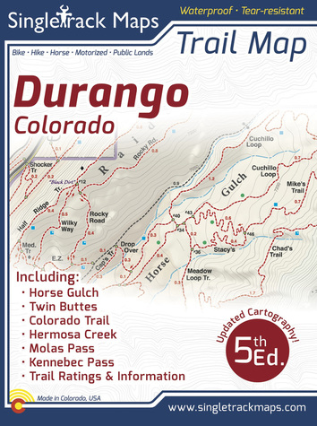
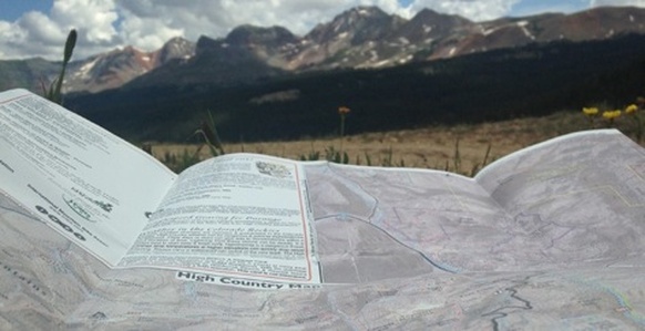
Durango Trail Map - 5th Edition
The Colorado Trail. Molas Pass to Durango
“Molas” - Molas Pass to Bolam Pass - Seg. 25 “Blackhawk” - Bolam Pass to Hotel Draw Rd - Seg. 26 “Highline” - Hotel Draw Rd to Kennebec Pass - Seg. 27 “Sliderock” - Kennebec Pass to Junction Creek - Seg. 28 Printed on waterproof & tear resistant paper for rugged toughness! Map Details:
Trail Difficulty Ratings: Easy, Medium, Difficult Scale 1:18,300 - 1in = 0.29mi or 1in = 0.46km High Country Scale 1:107,000 - 1in = 1.7mi or 1in = 2.7km Detailed Contour Lines. Contour Interval = 30ft Measures 4” x 5.5” folded and 34” x 22” fully open Updated - 5th Edition - Printed September 2016 Also Includes;
Campground Information Ride Descriptions for the best Durango rides Mileage (km) & Elevation Gain / Loss |
|
Why we are different
|
Pocket Size!
Our maps are designed to easily fit into a jersey pocket, bike shorts or just a regular pocket! No need to take your backpack off and dig out that map. 
|
|

|
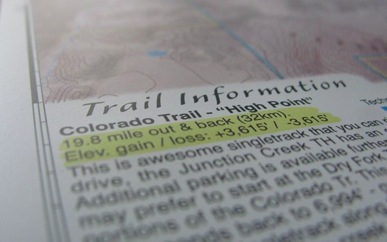
Ride Stats & Trail Notes
Quick statistics on local rides. Showing mileage & kilometers. Elevation gain / loss. Trail notes like Hike-A-Bike sections and other notes. 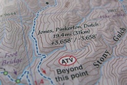
|
Waterproof Paper
Printed on waterproof and tear-resistant paper for rugged toughness. Doubles as an umbrella during those unexpected downpours :) 
|
Field Checked & Accurate!
Field checked cartography for the most accurate and up-to-date map available! We don’t rely on other parties for our data, we get outside and collect our own trail and geographic data.
Field checked cartography for the most accurate and up-to-date map available! We don’t rely on other parties for our data, we get outside and collect our own trail and geographic data.
|
Trail Information
Trail information panels are included on each side of the map. These information panels describe the most popular local rides and include specific ride stats like mileage and elevation gain / loss. Want to plan out your ride the night before? These descriptions help you decide what to do and what to expect. Also includes important Campground Information! |
|
|
Animas River Trail
Walk or ride this paved path that cuts through the middle of Durango. Check out the DSNGRR as it follows the trail. 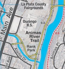
|
Important Stuff
Quickly look up emergency contact info. Side panels list contact information for various local agencies. 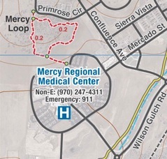
|
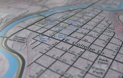
Detailed Roads
All of Durango’s roads cleanly labeled so you can navigate to the Trailhead, the local Shops,
Campgrounds or most important the local Microbreweries!
All of Durango’s roads cleanly labeled so you can navigate to the Trailhead, the local Shops,
Campgrounds or most important the local Microbreweries!
Local
Made in Colorado! From the cartography to the final printing. Every step takes place in Colorado. Not only are these maps made in Colorado, but, they are only available at locally owned stores. Buy Local!
Made in Colorado! From the cartography to the final printing. Every step takes place in Colorado. Not only are these maps made in Colorado, but, they are only available at locally owned stores. Buy Local!


|

|
© 2023 Singletrack Maps, LLC • All Rights Reserved.