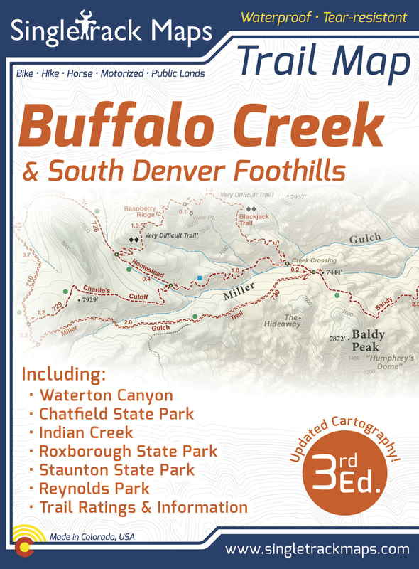
Buffalo Creek Trail Map (& South Denver) - 3rd Edition
Printed on waterproof & tear resistant paper for rugged toughness!
Map Details:
Also Includes;
|
Purchase Online- $13.99 - Click here: Buffalo Creek Trail Map
|
|
Beautiful Cartography!
Cartography is a craft and we have taken an enormous effort to create a beautiful map that clearly displays this wonderful geographic area. 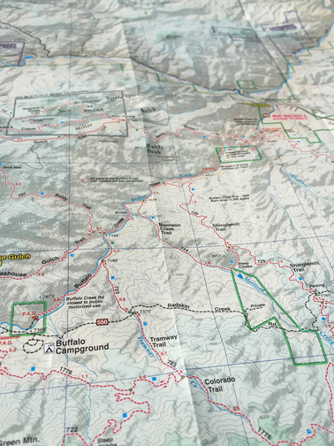
Detailed
We have spent years collecting geographic data and using local knowledge to give you the most detailed cartography for Buffalo Creek & the Front Range. Lots of the information and geographic knowledge on this map can't be found on any other maps! 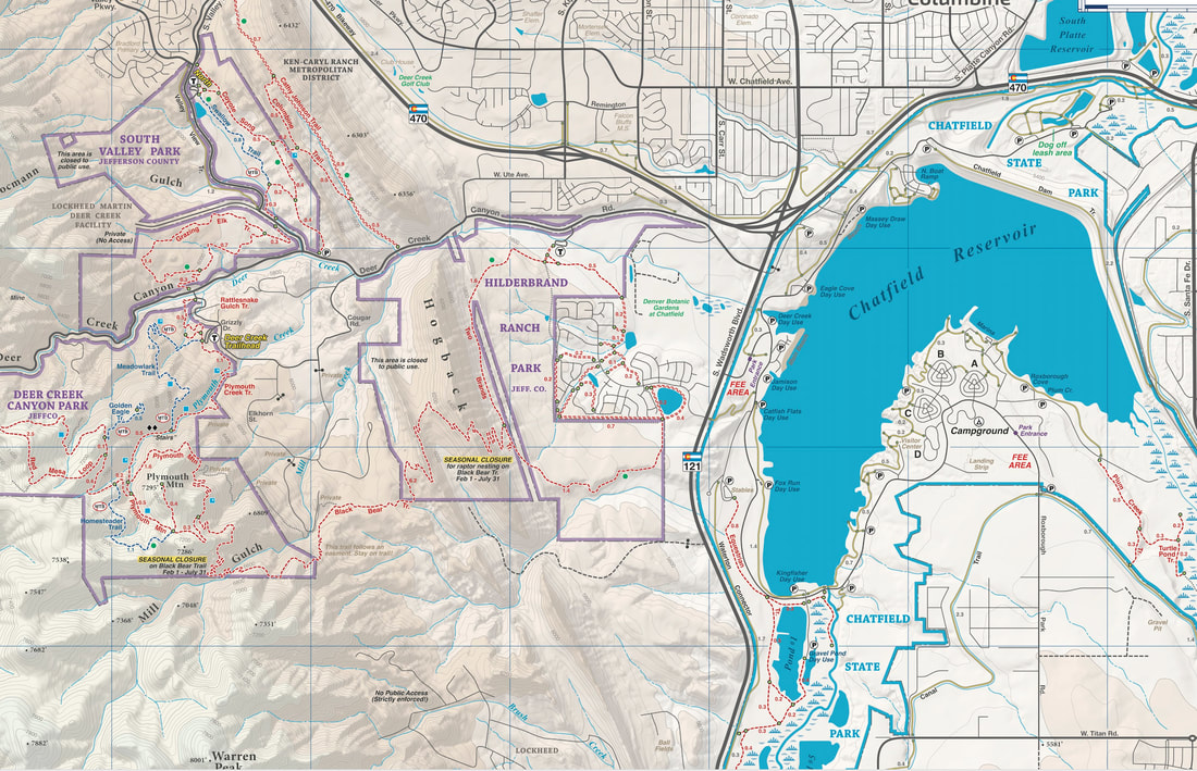
|
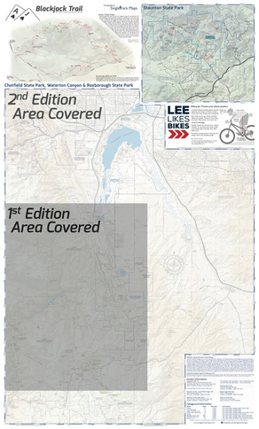
Expanded Boundaries
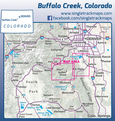
We didn't just publish a new edition. We recreated our cartography from scratch and expanded the boundaries to cover a larger area and more trails! Side 1 - Buffalo Creek Recreation Area
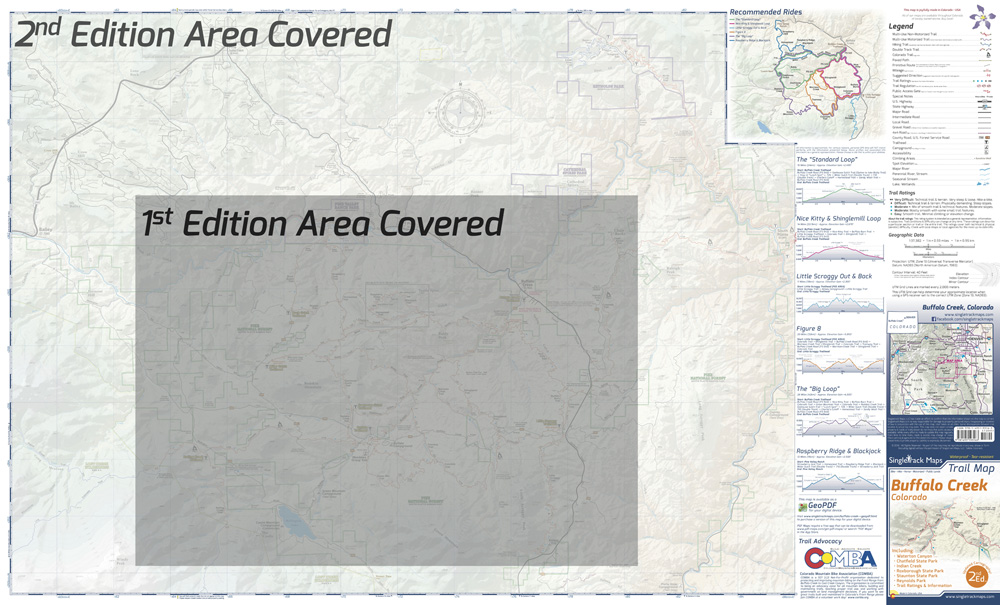
Side 2 - Chatfield SP, Waterton, Indian Creek, Staunton SP
|
Why we are different
|
Pocket Size!
Our maps are designed to easily fit into a jersey pocket, bike shorts or just a regular pocket! No need to take your backpack off and dig out that map. 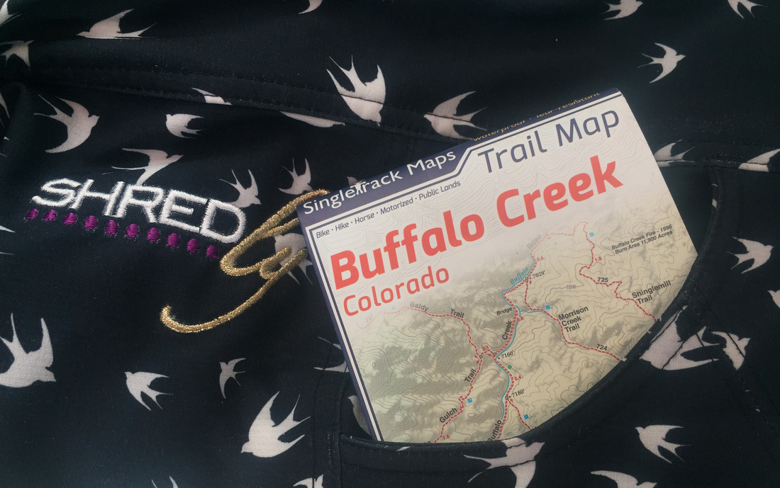
|
Trail Ratings
Trail segments are rated based on difficulty. These ratings help you choose a trail to suite what you want to ride. Simple and easy to understand. 
|
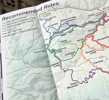
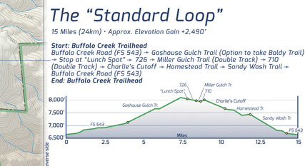
Recommended Rides (with Map, Descriptions & Profiles)
|
|
|
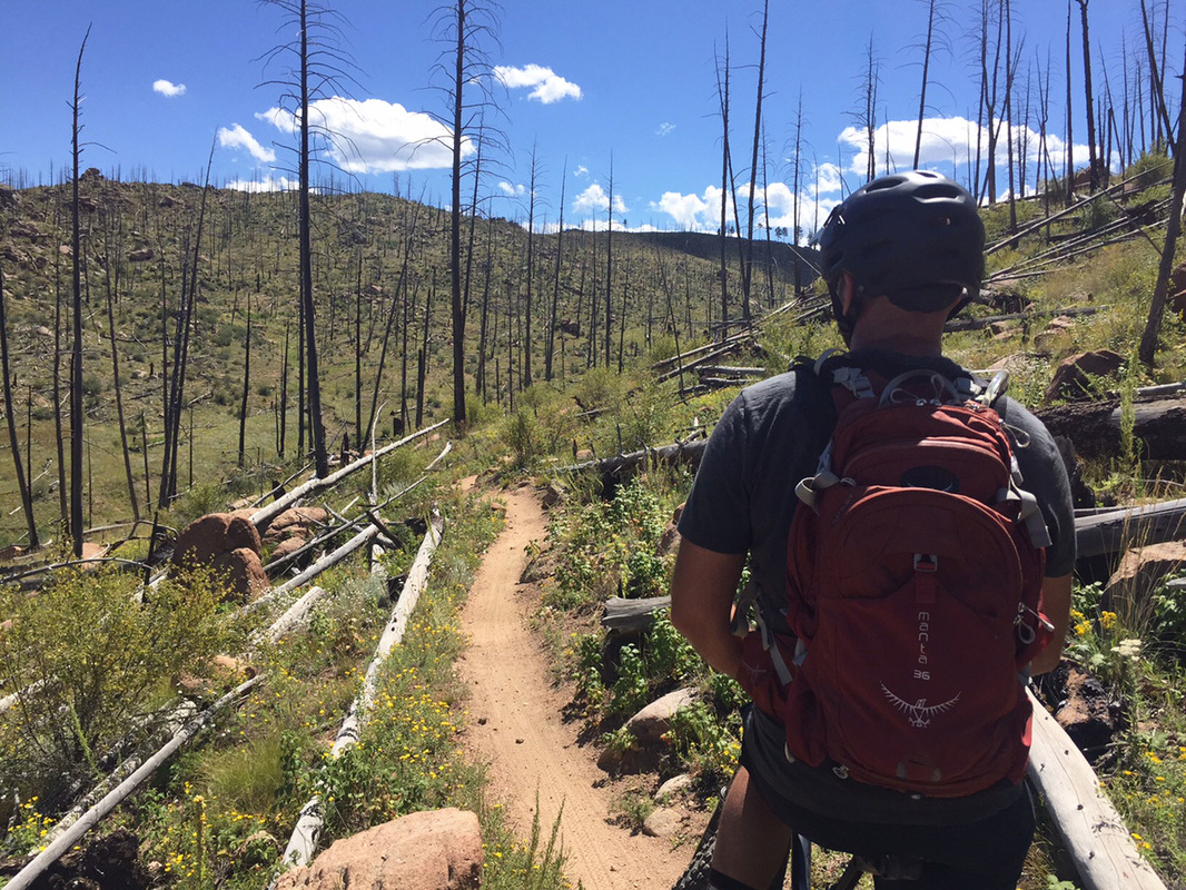
Field Checked in person!
Field checked cartography for the most up-to-date map available! We don’t rely on other parties for our data, we get outside and collect our own trail and geographic data. We are cartographers and our job is to make the best possible map for you, the user. We are NOT web programers putting digital overlays onto web maps just so that we can earn money from advertising. |
|
|
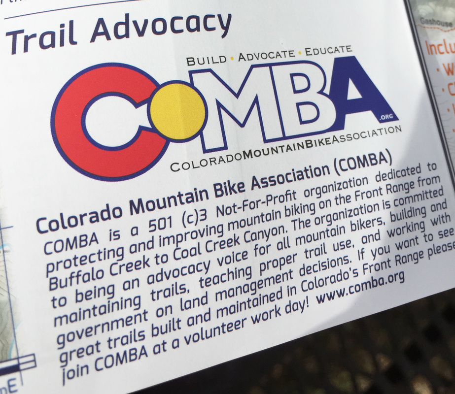
Local Information
Please visit www.comba.org for information about this local organization, to volunteer for a trail build day or to join. |
|
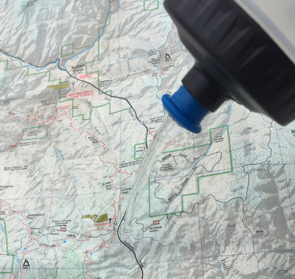
Waterproof Paper
Printed on waterproof and tear-resistant paper for rugged toughness. Doubles as an umbrella during those unexpected downpours :) |
|

|
Skills tip specific to the local trails at Buffalo Creek!
Lee McCormack from www.leelikesbikes.com, a world renowned mountain bike skills coach spells out how to improve your ride at Buffalo Creek with a skills tip and graphic specific to Buffalo Creeks sandy/decomposed granite trails. Lee literally wrote the book on mountain bike skills. Mastering Mountain Bike Skills 2nd Edition. |
|
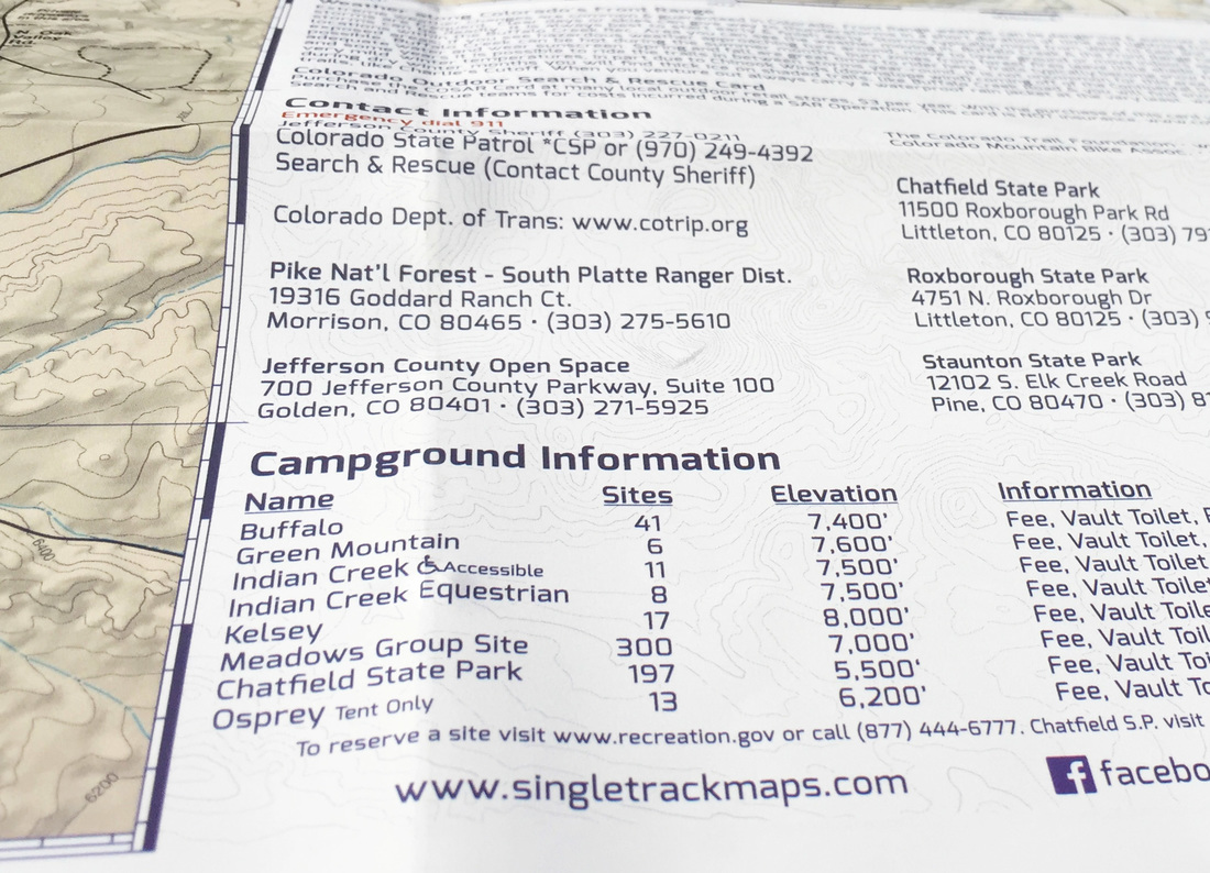
Important Information
Campground Information, detailed map notes & more! |
|
|
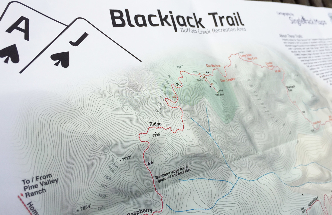
Blackjack Trail Detail
Blackjack trail has quickly become the premier technical trail on Colorado's Front Range. This detail map includes trail obstacle names, detailed contours lines and geographic information. |
See the Whole Picture
Stop staring at that tiny phone screen & see the entire landscape in one glance on this map! Beautiful and accurate cartography gives you the "big picture" view without having to scroll around on a 4" digital screen.
Stop staring at that tiny phone screen & see the entire landscape in one glance on this map! Beautiful and accurate cartography gives you the "big picture" view without having to scroll around on a 4" digital screen.
No batteries or power required, ever!
Local
Made in Colorado! From the cartography to the final printing. Every step takes place in Colorado. Not only are these maps made in Colorado, but they are only available at locally owned stores. Buy Local!
Made in Colorado! From the cartography to the final printing. Every step takes place in Colorado. Not only are these maps made in Colorado, but they are only available at locally owned stores. Buy Local!


|

|
© 2023 Singletrack Maps, LLC • All Rights Reserved.